
IMAGES TAKEN NEAR TO
Craymere Beck, MELTON CONSTABLE, NR24 2LR
Introduction
This page details the photographs taken nearby to NR24 2LR by members of the Geograph project.
The Geograph project started in 2005 with the aim of publishing, organising and preserving representative images for every square kilometre of Great Britain, Ireland and the Isle of Man.

There are currently over 7.5m images from over14,400 individuals and you can help contribute to the project by visiting https://www.geograph.org.uk
Image Map
Images are licensed for reuse under creativecommons.org/licenses/by-sa/2.0
Notes
- Clicking on the map will re-center to the selected point.
- The higher the marker number, the further away the image location is from the centre of the postcode.
Image Listing (20 Images Found)
Images are licensed for reuse under creativecommons.org/licenses/by-sa/2.0
Image
Details
Distance
1
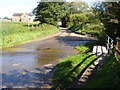
Water Way!
The ford at Craymere Beck Road. Even in the drier weather, the stream still has a steady flow.
Image: © David Williams
Taken: 26 Aug 2007
0.02 miles
2
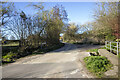
Craymere Beck Road
Ford at Craymere Beck Road
Image: © P Gaskell
Taken: Unknown
0.07 miles
3
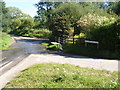
Ford
The stream crossing Craymere Beck Road near Briston.
Image: © David Williams
Taken: 26 Aug 2007
0.07 miles
4
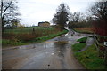
Ford at Craymere Beck
This ford is found on Craymere Beck Road on the road out of Briston.
Image: © John Walton
Taken: 17 Mar 2012
0.07 miles
5
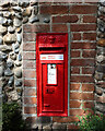
Post box on Craymere Beck Road
See Image for the location.
Image: © Hugh Venables
Taken: 16 Jul 2022
0.08 miles

8
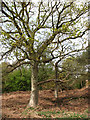
Lumley and Irvin Woods
Presumed to once have been the location of clay pits, the ground on the southwestern edge of Lumley and Irvin Woods, beside Mill Lane, is damp where it borders on the road and overgrown with bracken higher up. No Scots pines are growing here.
Marked on OS maps as Pegg's Plantation this area once used to be part of the old Briston Common. It is now a privately owned woodland - privately owned but walkers are very welcome here. Under the stewardship of its owners several paths were opened up; some of the predominant Scots pines, planted during the 1960s, are being felled (marked with white paint) to allow more room and light for a more diverse vegetation. Young trees of various different species have been planted, and in order to provide habitats and shelter for wildlife not all dead wood is removed. See http://www.geograph.org.uk/photo/786559 for more detailed information.
Image: © Evelyn Simak
Taken: 3 May 2008
0.13 miles
9
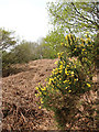
Bracken and gorse
In summer this area will be impenetrable. Presumed to once have been the location of clay pits, the ground on the southwestern edge of Lumley and Irvin Woods, beside Mill Lane, is damp where it borders on the road and overgrown with bracken higher up. No Scots pines are growing here.
Marked on OS maps as Pegg's Plantation this area once used to be part of the old Briston Common. It is now a privately owned woodland - privately owned but walkers are very welcome here. Under the stewardship of its owners several paths were opened up; some of the predominant Scots pines, planted during the 1960s, are being felled (marked with white paint) to allow more room and light for a more diverse vegetation. Young trees of various different species have been planted, and in order to provide habitats and shelter for wildlife not all dead wood is removed. See http://www.geograph.org.uk/photo/786559 for more detailed information.
Image: © Evelyn Simak
Taken: 3 May 2008
0.14 miles
10
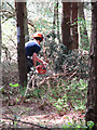
Thinning out
Work is underway to tidy up and clear undergrowth in this section of Lumley and Irvin Woods.
Marked on OS maps as Pegg's Plantation this area once used to be part of the old Briston Common. It is now a privately owned woodland - privately owned but walkers are very welcome here. Under the stewardship of its owners several paths were opened up; some of the predominant Scots pines, planted during the 1960s, are being felled (marked with white paint) to allow more room and light for a more diverse vegetation. Young trees of various different species have been planted, and in order to provide habitats and shelter for wildlife not all dead wood is removed. See http://www.geograph.org.uk/photo/786559 for more detailed information.
Image: © Evelyn Simak
Taken: 3 May 2008
0.15 miles