IMAGES TAKEN NEAR TO
Bayses Lane, MELTON CONSTABLE, NR24 2BA
Introduction
This page details the photographs taken nearby to Bayses Lane, NR24 2BA by members of the Geograph project.
The Geograph project started in 2005 with the aim of publishing, organising and preserving representative images for every square kilometre of Great Britain, Ireland and the Isle of Man.

There are currently over 7.5m images from over14,400 individuals and you can help contribute to the project by visiting https://www.geograph.org.uk
Image Map
Images are licensed for reuse under creativecommons.org/licenses/by-sa/2.0
Notes
- Clicking on the map will re-center to the selected point.
- The higher the marker number, the further away the image location is from the centre of the postcode.
Image Listing (10 Images Found)
Images are licensed for reuse under creativecommons.org/licenses/by-sa/2.0
Image
Details
Distance
1
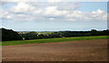
Lobb's Valley, Briningham
Looking over Lobb's valley, to the north, from the B1110.
Image: © Jurek and Trish Sienkiewicz
Taken: 30 Sep 2006
0.09 miles
2
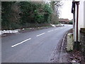
To Dereham 14
Old milestone on the A.148 at Briningham, Norfolk. For close up view see http://www.geograph.org.uk/photo/1639879
Image: © Keith Evans
Taken: 29 Dec 2009
0.15 miles
3

Old Milestone (west face) by the B1110, Dereham Road, Briningham Parish
Carved stone post by the B1110, in parish of BRININGHAM (NORTH NORFOLK District), by Stables Cottage, close to wall on very narrow verge, on West side of road. Erected by an unknown authority in the 19th century.
Inscription reads:- : 4 / MILES / TO / HOLT : : BRININGHAM : : 14 / MILES / TO / DEREHAM :
Listed.
Milestone Society National ID: NO_HD04.
Image: © CW Haines
Taken: 3 Dec 2014
0.15 miles
4

Old Milestone (east face) by the B1110, Dereham Road, Briningham Parish
Carved stone post by the B1110, in parish of BRININGHAM (NORTH NORFOLK District), by Stables Cottage, close to wall on very narrow verge, on West side of road. Erected by an unknown authority in the 19th century.
Inscription reads:- : 4 / MILES / TO / HOLT : : BRININGHAM : : 14 / MILES / TO / DEREHAM :
Listed.
Milestone Society National ID: NO_HD04.
Image: © CW Haines
Taken: 3 Dec 2014
0.15 miles
5
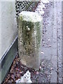
Old Milestone
Old milestone on the A.148 at Briningham, Norfolk. For overall view see http://www.geograph.org.uk/photo/1639877
Image: © Keith Evans
Taken: 29 Dec 2009
0.16 miles
6
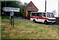
Sharrington Community Bus
The Sharrington Community bus was supplied by the Eastern Counties Bus Company and driven by volunteer drivers from the local community. Starting from Sharrington, it is seen in Briningham on the B1110. It will pick up passengers for Fakenham from a number of the local villages. The sign indicates the road to Melton Constable. The barn houses farm machinery on Bayse Farm.
Image: © Martin Addison
Taken: Unknown
0.17 miles
7
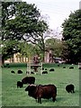
Black Sheep
Rare Breed sheep graze in the grounds of Briningham House, which is visible through the trees.
Image: © Martin Addison
Taken: Unknown
0.19 miles

9
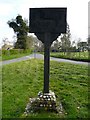
Village Sign
The village sign at Briningham, Norfolk. I hope to go back soon and retake this picture when the sun is in a better position.
Image: © Craig Tuck
Taken: 19 Apr 2009
0.20 miles