IMAGES TAKEN NEAR TO
Lincoln Street, NORWICH, NR2 3LA
Introduction
This page details the photographs taken nearby to Lincoln Street, NR2 3LA by members of the Geograph project.
The Geograph project started in 2005 with the aim of publishing, organising and preserving representative images for every square kilometre of Great Britain, Ireland and the Isle of Man.

There are currently over 7.5m images from over14,400 individuals and you can help contribute to the project by visiting https://www.geograph.org.uk
Image Map
Images are licensed for reuse under creativecommons.org/licenses/by-sa/2.0
Notes
- Clicking on the map will re-center to the selected point.
- The higher the marker number, the further away the image location is from the centre of the postcode.
Image Listing (105 Images Found)
Images are licensed for reuse under creativecommons.org/licenses/by-sa/2.0
Image
Details
Distance
4

Warwick Street Social, Norwich
This pub has a modern feel and was known as the Mad Moose until May 2016. It stands in the V between Dover Street and Warwick Street.
Image: © Stephen McKay
Taken: 23 Feb 2019
0.08 miles
5
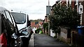
Warwick Street and Mile Cross tower blocks
The pavement of Warwick Street, Norwich, with the Mile Cross tower blocks visible in the distance.
Image: © Sebastian Doe
Taken: 12 Nov 2019
0.10 miles

8
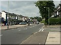
Unthank Road
The heart of Norwich's Golden Triangle, beloved of students and young professionals. The shopping area retains an impressive range of local independents, although sadly the hardware shop on the left of this shop, Burrell's, closed in 2008 after 100 years' trading. They retain a smaller shop elsewhere in Norwich.
After years of back and forth with the planners, a defunct petrol station at the other end of the road will now become a Tesco Express. Timeline: http://www.norwichgreenparty.org/campaigns/unthank_tesco/unthank_tesco.html
Image: © Katy Walters
Taken: 16 Jul 2005
0.11 miles
9
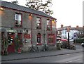
The Eaton Cottage
Bar and lounge on the corner of Mount Pleasant and Unthank Road.
Image: © Lis Burke
Taken: 18 Mar 2009
0.11 miles