
IMAGES TAKEN NEAR TO
Northfield Crescent, WELLS-NEXT-THE-SEA, NR23 1LR
Introduction
This page details the photographs taken nearby to Northfield Crescent, NR23 1LR by members of the Geograph project.
The Geograph project started in 2005 with the aim of publishing, organising and preserving representative images for every square kilometre of Great Britain, Ireland and the Isle of Man.

There are currently over 7.5m images from over14,400 individuals and you can help contribute to the project by visiting https://www.geograph.org.uk
Image Map
Images are licensed for reuse under creativecommons.org/licenses/by-sa/2.0
Notes
- Clicking on the map will re-center to the selected point.
- The higher the marker number, the further away the image location is from the centre of the postcode.
Image Listing (126 Images Found)
Images are licensed for reuse under creativecommons.org/licenses/by-sa/2.0
Image
Details
Distance
1
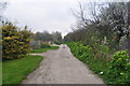
Remains of the Harbour Branch
A short line was built three years after the railway arrived in 1860 to help build freight traffic. A small embankment, cutting and bridge was all that was needed. Now most of it forms a footpath.
Image: © Ashley Dace
Taken: 15 Apr 2010
0.03 miles
2
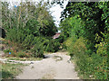
Trackbed of the former harbour line
The dismantled short track which ran from the railway station to the quay here turns into a footpath. This section was opened in 1860, three years after the railway arrived in the town.
Image: © Evelyn Simak
Taken: 11 Jul 2010
0.04 miles
3
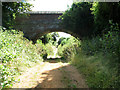
View along the former trackbed of the harbour line
The (dismantled) short track which ran from the railway station to the quay has been turned into a footpath. The section was opened in 1860, three years after the railway arrived in the town.
Image: © Evelyn Simak
Taken: 11 Jul 2010
0.05 miles
5
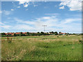
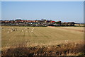
The harbour line in Wells-next-the-Sea
The course of the dismantled short track which ran from the railway station to the quay can be seen in the background denoted by the line of trees that are now growing on the dismantled trackbed. This section was opened in 1860, three years after the railway arrived in the town.
Image: © Evelyn Simak
Taken: 11 Jul 2010
0.08 miles
6
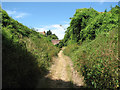
Cutting on the former harbour line
The (dismantled) short track which ran from the railway station to the quay has been turned into a footpath. The section was opened in 1860, three years after the railway arrived in the town.
Image: © Evelyn Simak
Taken: 11 Jul 2010
0.08 miles
7
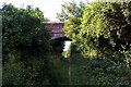
Remains of Wells Harbour branch line
This section of the short branch from the terminus at Wells to the sea front survives as a byway running in a shallow cutting. The brick overbridge carries Northfield Lane.
Image: © Tiger
Taken: 25 Jul 2009
0.08 miles
8
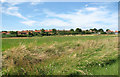
Wells-next-the-Sea viewed from the south-east
Image: © Evelyn Simak
Taken: 11 Jul 2010
0.09 miles
9
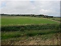
Wells-Next-The-Sea
Looking back from the seawall.
Image: © Hugh Venables
Taken: 24 Aug 2008
0.09 miles
10
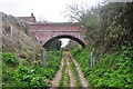
Wells on Sea Harbour Line
A short spur from the railway station http://www.geograph.org.uk/photo/1806921 to the quay, transporting goods from the port to East Anglia and beyond. This is the only bridge on the section taking Northfield Lane over the footpath.
It was opened in 1860, three years after the railway arrived in the town.
Image: © Ashley Dace
Taken: 15 Apr 2010
0.09 miles