IMAGES TAKEN NEAR TO
Fryer Close, WELLS-NEXT-THE-SEA, NR23 1FE

Introduction

This page details the photographs taken nearby to Fryer Close, NR23 1FE by members of the Geograph project.

The Geograph project started in 2005 with the aim of publishing, organising and preserving representative images for every square kilometre of Great Britain, Ireland and the Isle of Man.

There are currently over 7.5m images from over14,400 individuals and you can help contribute to the project by visiting https://www.geograph.org.uk

Image Map


Images are licensed for reuse under creativecommons.org/licenses/by-sa/2.0
Notes
  • Clicking on the map will re-center to the selected point.
  • The higher the marker number, the further away the image location is from the centre of the postcode.

Image Listing (587 Images Found)

Images are licensed for reuse under creativecommons.org/licenses/by-sa/2.0
  • ...
Image
Details
Distance
1
New Wells Police Station
The new, rather colourful patrol base for Norfolk Constabulary at Wells. The previous Police Station built in 1962 was demolished and the grounds are being developed as a patrol office and bungalows.
Image: © Bill Sibley Taken: 11 Feb 2009
0.03 miles
2
Artistic fence at entrance to Scrira Offshore Energy, Polka Road, Wells
This is at the end of the public footpath called School Alley, the sign for which can be seen in the background.
Image: © John Brightley Taken: 5 May 2012
0.05 miles
3
Sculptural metal gate at entrance to Scrira Offshore Energy
This is the entrance gate to the offices of Scrira Offshore Energy who are operators of the Sheringham Shoal Offshore Wind Farm, and the metalwork seems to represent a shoal of fish.
Image: © John Brightley Taken: 5 May 2012
0.05 miles
4
Standard Rd
Image: © N Chadwick Taken: 2 Jan 2014
0.06 miles
5
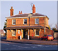
The Old Station, Wells-next-the Sea
Opened in 1857 as the terminus of the Wells & Fakenham Railway, later part of the Great Eastern Railway. From 1866 it also served the West Norfolk Junction Railway from Heacham (between Kings Lynn and Hunstanton). It closed in 1964, and is now a pottery/bookshop. For a closeup of the Victorian postbox visible behind the blue car, see Image
Image: © Ian Capper Taken: 14 Aug 2008
0.07 miles
6
Victorian postbox, Wells-next-the-Sea
In the wall of the Old Station (see Image).
Image: © Ian Capper Taken: 14 Aug 2008
0.07 miles
7
Former Railway Station at Wells (2)
This is the frontage of the one-time railway terminus station at Wells. The station was opened in 1857. Two Great Eastern Railway lines met here: one from Fakenham and one from Heacham (a third short line served Wells harbour). The line to Heacham was closed after the floods of 1953 but the line to Fakenham survived until the early 1960s. The station building is now a secondhand bookshop and pottery.
Image: © Andy F Taken: Unknown
0.07 miles
8
The Old Station
The railway line at Wells-Next-The-Sea has now been dismantled following being closed in the Beeching cuts of the 1960s. The station now contains a bookshop and pottery. www.wells-guide.co.uk
Image: © Colin Smith Taken: 26 Mar 2011
0.07 miles
9
The Old Station
Variously known as Wells, Wells-on-Sea, and Wells-next-the-Sea. Closed in 1964.
Image: © Keith Edkins Taken: 26 May 2012
0.07 miles
10
Reused ex-railway station
Wells station is now a bookshop and pottery.
Image: © SMJ Taken: 28 Jun 2014
0.07 miles
  • ...