IMAGES TAKEN NEAR TO
Westfield Avenue, WELLS-NEXT-THE-SEA, NR23 1BY

Introduction

This page details the photographs taken nearby to Westfield Avenue, NR23 1BY by members of the Geograph project.

The Geograph project started in 2005 with the aim of publishing, organising and preserving representative images for every square kilometre of Great Britain, Ireland and the Isle of Man.

There are currently over 7.5m images from over14,400 individuals and you can help contribute to the project by visiting https://www.geograph.org.uk

Image Map


Images are licensed for reuse under creativecommons.org/licenses/by-sa/2.0
Notes
  • Clicking on the map will re-center to the selected point.
  • The higher the marker number, the further away the image location is from the centre of the postcode.

Image Listing (61 Images Found)

Images are licensed for reuse under creativecommons.org/licenses/by-sa/2.0
  • ...
Image
Details
Distance
1
Ordnance Survey Flush Bracket G3213
This can be found on the wall of a house - a private dwelling - in Westfield Avenue, Wells-Next-The-Sea.
Image: © Peter Wood Taken: 11 Nov 2014
0.06 miles
2
Westfield Avenue in Wells-Next-The-Sea
Looking northward.
Image: © Peter Wood Taken: 11 Nov 2014
0.06 miles
3
A149 Mill Road, Wells-next-the-Sea
Image: © Colin Pyle Taken: 5 Aug 2013
0.08 miles
4
Arch House
Historic house with village sign on Mill Road, Wells-Next-The-Sea. The house has connections with the Fryer family - John Fryer was an officer on The Bounty, Captain William Bligh's ship - and is now a very comfortable B&B establishment.
Image: © Colin Smith Taken: 25 Mar 2011
0.10 miles
5
Mill Road around Wells
Image: © Hugh Venables Taken: 29 Dec 2018
0.11 miles
6
Arch House, Mill Road
Spring at the house with historic connections to the Fryer family in Wells-Next-The-Sea. John Fryer was an officer during the "mutiny on the Bounty".
Image: © Colin Smith Taken: 27 Mar 2011
0.11 miles
7
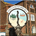
Village Sign
The village sign at Wells-Next-The-Sea, Norfolk
Image: © Craig Tuck Taken: 5 Apr 2009
0.12 miles
8
Wells town sign
The sign at Wells is relatively new and is based around an anchor with the rope creating a circular ground. It depicts pine trees which are prolific a few miles inland, all along the north Norfolk coast. A fishing vessel and bucket and spade tells the other side of the history. Below the sign are two fish supporters.
Image: © Adrian S Pye Taken: 17 Dec 2020
0.12 miles
9
Wells town sign
The sign at Wells is relatively new and is based around an anchor with the rope creating a circular ground. It depicts pine trees which are prolific a few miles inland, all along the north Norfolk coast. A fishing vessel and bucket and spade tells the other side of the history. Below the sign are two fish supporters.
Image: © Adrian S Pye Taken: 17 Dec 2020
0.12 miles
10
Holkham Road entering Wells-next-the-Sea
Image: © Hugh Venables Taken: 11 Sep 2015
0.13 miles
  • ...