
IMAGES TAKEN NEAR TO
Ampthill Street, NORWICH, NR2 2RG
Introduction
This page details the photographs taken nearby to Ampthill Street, NR2 2RG by members of the Geograph project.
The Geograph project started in 2005 with the aim of publishing, organising and preserving representative images for every square kilometre of Great Britain, Ireland and the Isle of Man.

There are currently over 7.5m images from over14,400 individuals and you can help contribute to the project by visiting https://www.geograph.org.uk
Image Map
Images are licensed for reuse under creativecommons.org/licenses/by-sa/2.0
Notes
- Clicking on the map will re-center to the selected point.
- The higher the marker number, the further away the image location is from the centre of the postcode.
Image Listing (555 Images Found)
Images are licensed for reuse under creativecommons.org/licenses/by-sa/2.0
Image
Details
Distance
1
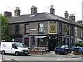
Kimberley Arms, Kimberley Street, Norwich
Modest little Victorian white brick pub.
It has sadly closed since this photo.
Image: © Stephen Richards
Taken: 17 Jun 2013
0.04 miles
2
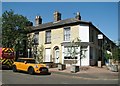
NR2 Hotel - currently closed
This hotel is located by the junction of Kimberley and Trory streets and is currently closed due to the Coronavirus pandemic lockdown.
Image: © Evelyn Simak
Taken: 31 May 2020
0.04 miles
3
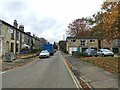
Trory Street, Norwich
Looking down Trory Street in Norwich.
Image: © Sebastian Doe
Taken: 24 Oct 2020
0.04 miles

5

Elim Pentecostal Church in Trory Street
The church, currently closed due to the Coronavirus pandemic lockdown, is one of Norwich's Food Network providers and offers free breakfast and dinner once a week.
Image: © Evelyn Simak
Taken: 31 May 2020
0.05 miles
6

Elim Pentecostal Church in Trory Street
The church, currently closed due to the Coronavirus pandemic lockdown, is one of Norwich's Food Network providers and offers free breakfast and dinner once a week.
Image: © Evelyn Simak
Taken: 31 May 2020
0.05 miles
8
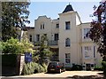
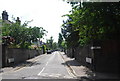
Accountants offices in Unthank Road
On the 1884 OS map this is shown as Tamworth Terrace.
Image: © Evelyn Simak
Taken: 3 Jul 2018
0.06 miles
9
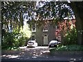
48 Unthank Road
This area was developed in the late 19th century on land owned by Colonel Unthank. The street layout was planned by the Norwich architect E Boardman and the houses were then rented to the middle and skilled artisan classes.
Image: © Evelyn Simak
Taken: 3 Jul 2018
0.06 miles
10

Winchester Tower as seen from Trory Street
The Winchester Tower is located at 1-95 Troy Street, off Vauxhall Street, and was designed by City Architect David Percival. It dates from 1965 and comprises 95 flats.
Image: © Evelyn Simak
Taken: 31 May 2020
0.07 miles