
IMAGES TAKEN NEAR TO
Bury Street, NORWICH, NR2 2DL
Introduction
This page details the photographs taken nearby to Bury Street, NR2 2DL by members of the Geograph project.
The Geograph project started in 2005 with the aim of publishing, organising and preserving representative images for every square kilometre of Great Britain, Ireland and the Isle of Man.

There are currently over 7.5m images from over14,400 individuals and you can help contribute to the project by visiting https://www.geograph.org.uk
Image Map
Images are licensed for reuse under creativecommons.org/licenses/by-sa/2.0
Notes
- Clicking on the map will re-center to the selected point.
- The higher the marker number, the further away the image location is from the centre of the postcode.
Image Listing (78 Images Found)
Images are licensed for reuse under creativecommons.org/licenses/by-sa/2.0
Image
Details
Distance
1

Gates in Mount Pleasant
Mount Pleasant feels like a country lane surrounded by urban development. Large individual houses interspersed with short terraces are set back from the road behind hedges, walls and gates. This is very different from nearby streets which have a more uniform appearance.
Image: © Lis Burke
Taken: 18 Mar 2009
0.05 miles
2

Mount Pleasant, Norwich
Mount Pleasant, Norwich, just past the Newmarket Street junction.
Image: © Sebastian Doe
Taken: 31 Mar 2020
0.05 miles
3

The Unthank Arms, Norwich
The pub is named after the Unthank family who were the nobility of Norwich. They arrived from Northumberland in the 17th century.
The family amassed about 2500 acres of land on their Heigham Estate, stretching from St Giles’ Gate southwards to Eaton. This meant that when William’s son and heir, Clement William Unthank, went courting the heiress of the Intwood Estate, Mary Anne Muskett, he could ride for most of the journey without leaving family parkland.
At first, Clement William and Mary Anne lived in Norwich at ‘Unthanks House’ near modern-day Bury and Onley Streets but in 1855 they moved to her childhood home, on the Intwood estate, at the outskirts of the city.
Read more here https://colonelunthanksnorwich.com/2016/01/30/colonel-unthank-and-the-golden-triangle/
Image: © Adrian S Pye
Taken: 10 Mar 2018
0.06 miles
4

Hanging sign for the Unthank Arms public house
http://www.geograph.org.uk/photo/5702550
Image: © Adrian S Pye
Taken: 10 Mar 2018
0.06 miles
5

Mount Pleasant and Newmarket Street junction, Norwich
The junction between Mount Pleasant and Newmarket Street in Norwich.
Image: © Sebastian Doe
Taken: 31 Mar 2020
0.07 miles
6

Gloucester Street
These buildings on the corner of Gloucester Street and Newmarket Street look interesting. The first floor and roof match the rest of the terraced houses for age and style, but the ground floor brickwork looks more recent, with one section quite modern.
Image: © Lis Burke
Taken: 12 Jun 2006
0.08 miles
7

Dozen Artisan Bakery, Norwich
The Dozen Artisan Bakery at the intersection between Newmarket Street and Gloucester Street in Norwich.
Image: © Sebastian Doe
Taken: 24 Jul 2019
0.11 miles


10
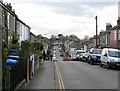
Newmarket Street
Newmarket Street runs parallel with Newmarket Road, but for a shorter distance. This is a residential area within easy walking distance of the city centre.
Image: © Lis Burke
Taken: 7 Apr 2009
0.12 miles