
IMAGES TAKEN NEAR TO
Pudding Lane, NORWICH, NR2 1RB
Introduction
This page details the photographs taken nearby to Pudding Lane, NR2 1RB by members of the Geograph project.
The Geograph project started in 2005 with the aim of publishing, organising and preserving representative images for every square kilometre of Great Britain, Ireland and the Isle of Man.

There are currently over 7.5m images from over14,400 individuals and you can help contribute to the project by visiting https://www.geograph.org.uk
Image Map
Images are licensed for reuse under creativecommons.org/licenses/by-sa/2.0
Notes
- Clicking on the map will re-center to the selected point.
- The higher the marker number, the further away the image location is from the centre of the postcode.
Image Listing (4748 Images Found)
Images are licensed for reuse under creativecommons.org/licenses/by-sa/2.0
Image
Details
Distance
1

Norwich: postbox № NR2 211, St. Peter?s Street
This hexagonal Victorian postbox is of the 'Penfold' design which is probably the best known design pre the standard cylindrical pillar box. It is currently out of service because of improvement works to the area above the Market – I am in fact looking through the fence by which the area is cordoned off. A temporary replacement box (of modern design) has been provided a few yards away.
The Guildhall on Gaol Hill is in the background.
Image: © Chris Downer
Taken: 29 Nov 2009
0.00 miles
2

The Sir Garnet, Norwich
The Sir Garnet is a pub in the centre of Norwich located next to the market and seen here with a backdrop of City Hall. It took its name in 1874 after Field Marshal Garnet Joseph Wolseley, 1st Viscount Wolseley, who had just conducted a successful campaign in Africa.
Image: © Stephen McKay
Taken: 26 Feb 2017
0.00 miles


5

Detail of Sir Garnet Wolseley, Market Place, Norwich
The building is older, but the Greek Doric entrance was added in the late C18th.
Image: © Stephen Richards
Taken: 16 Jun 2013
0.00 miles
6

People relaxing at Hay Hill
The church glimpsed in the background is St Peter Mancroft > https://www.geograph.org.uk/photo/1844785.
Image: © Evelyn Simak
Taken: 27 Jun 2018
0.00 miles

8

Houses above the Norwich Market
The two houses, a corner site, are 34 and 35, and 37 Gentleman's Walk, one being a shop and the other (at right) a public house known as the Sir Garnet's, which dates from the 15th century. Both buildings are Grade 2 listed.
Image: © Evelyn Simak
Taken: 27 Jun 2018
0.01 miles
9

34 and 35, and 37 Gentleman's Walk
The two houses, a corner site, are 34 and 35, and 37 Gentleman's Walk, one being a shop (Little Langleys, at left) and the other a public house known as the Sir Garnet's, which dates from the 15th century. Both buildings are Grade 2 listed. For a wider view see > http://www.geograph.org.uk/photo/5823148.
Image: © Evelyn Simak
Taken: 27 Jun 2018
0.01 miles
10
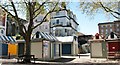
Closed stalls at the market place in Norwich
Image: © Evelyn Simak
Taken: 19 Apr 2020
0.01 miles