
IMAGES TAKEN NEAR TO
Foundry Close, FAKENHAM, NR21 9ND
Introduction
This page details the photographs taken nearby to Foundry Close, NR21 9ND by members of the Geograph project.
The Geograph project started in 2005 with the aim of publishing, organising and preserving representative images for every square kilometre of Great Britain, Ireland and the Isle of Man.

There are currently over 7.5m images from over14,400 individuals and you can help contribute to the project by visiting https://www.geograph.org.uk
Image Map
Images are licensed for reuse under creativecommons.org/licenses/by-sa/2.0
Notes
- Clicking on the map will re-center to the selected point.
- The higher the marker number, the further away the image location is from the centre of the postcode.
Image Listing (5 Images Found)
Images are licensed for reuse under creativecommons.org/licenses/by-sa/2.0
Image
Details
Distance
1
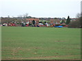
A colourful collection in Sculthorpe
An agricultural machinery works in the village near Fakenham, Norfolk
Image: © Richard Humphrey
Taken: 18 Mar 2011
0.08 miles
3
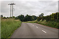
Power lines cross the B1355
East of Sculthorpe.
Image: © J.Hannan-Briggs
Taken: 15 Jun 2016
0.21 miles
4
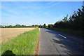
The B1355 Fakenham to South Creake Road
The road from Fakenham to South Creake and beyond.
Image: © Ashley Dace
Taken: 21 Sep 2010
0.23 miles
5
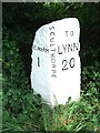
Old Milestone by The Street, Sculthorpe
Carved stone post by the UC road, in parish of SCULTHORPE (NORTH NORFOLK District), 20yds West of junction with A148, in verge against hedge, on North side of road. Wells stone, erected by the Wells to Fakenham turnpike trust in the 20th century.
Inscription reads:-
: (T)O / FAKENHAM / 1 : : SCULTHORPE : : TO / LYNN / 20 :
Norfolk HER.
NHER Number: 56749 https://www.heritagegateway.org.uk/Gateway/Results_Single.aspx?uid=MNF63160&resourceID=1002
Milestone Society National ID: NO_FKL01.
Image: © CW Haines
Taken: 10 Jul 2003
0.25 miles