
IMAGES TAKEN NEAR TO
The Common, FAKENHAM, NR21 9JA
Introduction
This page details the photographs taken nearby to The Common, NR21 9JA by members of the Geograph project.
The Geograph project started in 2005 with the aim of publishing, organising and preserving representative images for every square kilometre of Great Britain, Ireland and the Isle of Man.

There are currently over 7.5m images from over14,400 individuals and you can help contribute to the project by visiting https://www.geograph.org.uk
Image Map
Images are licensed for reuse under creativecommons.org/licenses/by-sa/2.0
Notes
- Clicking on the map will re-center to the selected point.
- The higher the marker number, the further away the image location is from the centre of the postcode.
Image Listing (6 Images Found)
Images are licensed for reuse under creativecommons.org/licenses/by-sa/2.0
Image
Details
Distance
3
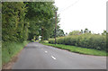
B1355 near West Barsham
Passing through an area of scattered houses.
Image: © J.Hannan-Briggs
Taken: 15 Jun 2016
0.05 miles
4
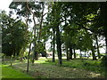
Caravan park screened by trees
Just north of Cranmer Hall in Norfolk
Image: © Richard Humphrey
Taken: 29 Jul 2012
0.06 miles
5
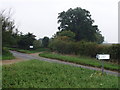
Roman Road
Difficult to imagine that this isolated spot in rural North Norfolk may well have been a busy crossing place nearly 2,000 years ago. The track which crosses the B1335 (Fakenham to Burnham) is a Roman road
Image: © David Williams
Taken: 15 Oct 2006
0.22 miles
6
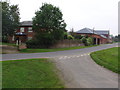
Farm in North Norfolk
This is Home Farm, close to the estate of Cranmer Hall. The hall itself was built in 1720 for the Duke of Wellington's Engineer General. Today the hall is made up of expensive holiday lets and there are holiday cottages in the grounds.
Image: © David Williams
Taken: 15 Oct 2006
0.22 miles