
IMAGES TAKEN NEAR TO
Sedge Close, FAKENHAM, NR21 8PS
Introduction
This page details the photographs taken nearby to Sedge Close, NR21 8PS by members of the Geograph project.
The Geograph project started in 2005 with the aim of publishing, organising and preserving representative images for every square kilometre of Great Britain, Ireland and the Isle of Man.

There are currently over 7.5m images from over14,400 individuals and you can help contribute to the project by visiting https://www.geograph.org.uk
Image Map
Images are licensed for reuse under creativecommons.org/licenses/by-sa/2.0
Notes
- Clicking on the map will re-center to the selected point.
- The higher the marker number, the further away the image location is from the centre of the postcode.
Image Listing (23 Images Found)
Images are licensed for reuse under creativecommons.org/licenses/by-sa/2.0
Image
Details
Distance
1
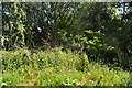
Yes a Railway Ran here
Hard to believe but 50 year have taken their toll on the old M&GN system. The line from Lynn to Melton Constable via Fakenham closed in 1959. Now it is overgrown (I didn't need to tell you that though!).
Image: © Ashley Dace
Taken: 3 Jun 2010
0.08 miles
2
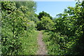
Old M&GN Line
A view of the ex Midland and Great Northern Joint Railway line from South Lynn to Melton Constable and beyond. The line closed, along with most of the M&GN system in 1959.
Image: © Ashley Dace
Taken: 3 Jun 2010
0.11 miles
3
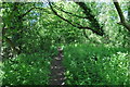
M&GN Line to Fakenham
A view of the well and truly closed line from Melton Constable to South Lynn via Fakenham West Image The route closed in 1959.
Image: © Ashley Dace
Taken: 3 Jun 2010
0.13 miles
4
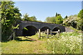
Bridge 1714 over the River Wensum
A nice bridge over the River Wensum, looking more like a small viaduct. This was bought last year by Giles de Lotbinière, managing director of Brandon firm Lignacite, securing the land at auction on February 17 with a winning bid of £12,000. Not that he can do anything with it though (and it seems this has happened) as it is protected trackbed.
Image: © Ashley Dace
Taken: 3 Jun 2010
0.14 miles
6
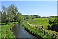
The View from Bridge 1714
The view from the trackbed of the dismantled GER line at Pudding Norton. The river being the young River Wensum.
Image: © Ashley Dace
Taken: 3 Jun 2010
0.16 miles
7
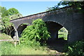
Bridge 1714 Pudding Norton
A nice bridge over the River Wensum, looking more like a small viaduct. This was bought last year by Giles de Lotbinière, managing director of Brandon firm Lignacite, securing the land at auction on February 17 with a winning bid of £12,000. Not that he can do anything with it though (and it seems this has happened) as it is protected trackbed.
Image: © Ashley Dace
Taken: 3 Jun 2010
0.16 miles
8
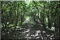
Wells to Wymondham Branchline
A view, looking towards Wymondham. This is a short section of the trackbed between bridge 1715 (behind me) and 1714 (in front). Fakenham East Station is only a short walk from here. The land is protected from development due to possible re instatement.
Image: © Ashley Dace
Taken: 3 Jun 2010
0.16 miles
9
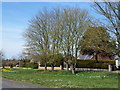
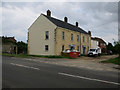
Norwich Road, Fakenham
At long last spring has arrived
Image: © Richard Humphrey
Taken: 21 Apr 2013
0.17 miles
10
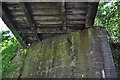
Old M&GN Bridge 1715
A rail over rail bridge, the track underneath being the M&GN Lynn to Fakenham to Melton Constable. Over was the GER trackbed from County School to Fakenham East Station. The M&GN closed in 1959 while the GER section lasted until 1974.
The signalling system can be seen here (or remains of it).
Image: © Ashley Dace
Taken: 3 Jun 2010
0.17 miles