IMAGES TAKEN NEAR TO
Norwich Road, FAKENHAM, NR21 8LA
Introduction
This page details the photographs taken nearby to Norwich Road, NR21 8LA by members of the Geograph project.
The Geograph project started in 2005 with the aim of publishing, organising and preserving representative images for every square kilometre of Great Britain, Ireland and the Isle of Man.

There are currently over 7.5m images from over14,400 individuals and you can help contribute to the project by visiting https://www.geograph.org.uk
Image Map
Images are licensed for reuse under creativecommons.org/licenses/by-sa/2.0
Notes
- Clicking on the map will re-center to the selected point.
- The higher the marker number, the further away the image location is from the centre of the postcode.
Image Listing (26 Images Found)
Images are licensed for reuse under creativecommons.org/licenses/by-sa/2.0
Image
Details
Distance
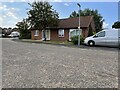
1
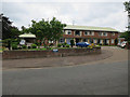
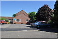
Cranmer House, Fakenham
NHS care home.
Image: © Hugh Venables
Taken: 26 Jun 2016
0.06 miles
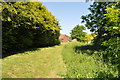
2
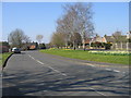
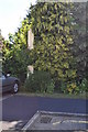
Norwich Road, Fakenham
View west towards town. Tower of Parish Church http://www.geograph.org.uk/photo/203588 can just be seen on horizon above right hand bend of road.
Image: © Nigel Jones
Taken: 26 Mar 2007
0.11 miles
3
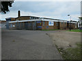
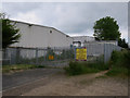
Aldiss distribution centre, Fakenham
Furniture and homeware store in Norwich and Fakenham.
Image: © Hugh Venables
Taken: 26 Jun 2016
0.12 miles
6
View to Fakenham East Station
A view of the trackbed, now a garden into Fakenham East Station. There was once much industry here with maltings and stores, all now gone. Sheltered housing has sprung up on site.
See Image
Image: © Ashley Dace
Taken: 3 Jun 2010
0.13 miles
7
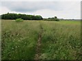
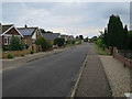
Grassy area, Fakenham Industrial Estate
Image: © Hugh Venables
Taken: 26 Jun 2016
0.13 miles
8
Fakenham East railway station (site), Norfolk
Opened in 1849 by the Eastern Counties Railway, later part of the Great Eastern Railway, on the line from Wymondham to Wells, this station closed in 1964. Goods trains carried on until around 1980 when the track was lifted.
View north west approximately along the single platform which had the track to the right of it. The station buildings would have been just behind the current bungalow, and beyond that, a level crossing for Norwich Road. As can be seen, the site has been redeveloped as a housing estate.
Image: © Nigel Thompson
Taken: 4 Aug 2021
0.13 miles
9
Former Level Crossing post at Fakenham East Station
See Image]
Image: © Ashley Dace
Taken: 3 Jun 2010
0.14 miles
10
Site of Fakenham East Railway Station
This is the only station on the route (Wells to Wymondham) which has gone with out a trace (well almost). The station in 1969 can be seen here. A gate post from the crossing has been preserved but I think it has moved position from its old one. http://www.remembernorfolk.org/viewlarge.aspx?GI=23&MI=51000230317 The white post on the right is the level crossing post in the picture.
Image: © Ashley Dace
Taken: 3 Jun 2010
0.14 miles