
IMAGES TAKEN NEAR TO
Wellington Crescent, FAKENHAM, NR21 7PU
Introduction
This page details the photographs taken nearby to Wellington Crescent, NR21 7PU by members of the Geograph project.
The Geograph project started in 2005 with the aim of publishing, organising and preserving representative images for every square kilometre of Great Britain, Ireland and the Isle of Man.

There are currently over 7.5m images from over14,400 individuals and you can help contribute to the project by visiting https://www.geograph.org.uk
Image Map
Images are licensed for reuse under creativecommons.org/licenses/by-sa/2.0
Notes
- Clicking on the map will re-center to the selected point.
- The higher the marker number, the further away the image location is from the centre of the postcode.
Image Listing (8 Images Found)
Images are licensed for reuse under creativecommons.org/licenses/by-sa/2.0
Image
Details
Distance
1
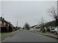
Lancaster Road, Blenheim Park
This was part of the living quarters on the old Sculthorpe Airfield
Image: © Adrian S Pye
Taken: 16 Nov 2018
0.08 miles
2
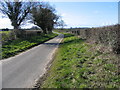
Syderstone Road, Blenheim Park, Syderstone
Looking west towards Syderstone with the gate to Sculthorpe Airfield behind the photographer
Image: © Nigel Jones
Taken: 21 Mar 2007
0.11 miles
3
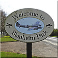
Blenheim Park village sign
Blenheim Park is on part of what was the Sculthorpe technical and domestic site and named after the Blenheim aircraft. The former military housing was refurbished to create Blenheim Park and Wicken Green Village. https://www.geograph.org.uk/photo/6793626
Image: © Adrian S Pye
Taken: 31 Mar 2021
0.15 miles
4
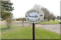
Blenheim Park village sign
Blenheim Park is on part of what was the Sculthorpe technical and domestic site and named after the Blenheim aircraft. The former military housing was refurbished to create Blenheim Park and Wicken Green Village. https://www.geograph.org.uk/photo/6793625
Image: © Adrian S Pye
Taken: 31 Mar 2021
0.15 miles
5
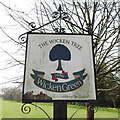
Wicken Green village sign
Wicken Green village is on and overlooks the abandoned air base of RAF Sculthorpe. https://www.geograph.org.uk/photo/6802550
Image: © Adrian S Pye
Taken: 31 Mar 2021
0.18 miles
6
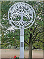
A new Wicken Green village sign for the Jubilee
Made especially for the Queen's Platinum Jubilee it is so much nicer than its predecessor.
Image: © Adrian S Pye
Taken: 21 Aug 2022
0.19 miles
7
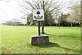
Wicken Green village sign
Wicken Green village is on and overlooks the abandoned air base of RAF Sculthorpe. https://www.geograph.org.uk/photo/6802548
Image: © Adrian S Pye
Taken: 31 Mar 2021
0.21 miles
8
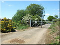
Inside gate No 1 on Syderstone Road
This gate would have formed part of the security around Sculthorpe Airfield when it was operational. It still remains locked although it is possible to gain access to either side of the gate. It probably formed part of the security for the living quarters which are now the non military community Blenheim Park and Wicken Green Village. The road behind me turns into a track which then goes through Gate No 2 (see http://www.geograph.org.uk/photo/2392510 ) and into a part of the airfield which is still secure.
Image: © Richard Humphrey
Taken: 3 May 2011
0.23 miles