
IMAGES TAKEN NEAR TO
Gormans Lane, FAKENHAM, NR21 7NP
Introduction
This page details the photographs taken nearby to Gormans Lane, NR21 7NP by members of the Geograph project.
The Geograph project started in 2005 with the aim of publishing, organising and preserving representative images for every square kilometre of Great Britain, Ireland and the Isle of Man.

There are currently over 7.5m images from over14,400 individuals and you can help contribute to the project by visiting https://www.geograph.org.uk
Image Map
Images are licensed for reuse under creativecommons.org/licenses/by-sa/2.0
Notes
- Clicking on the map will re-center to the selected point.
- The higher the marker number, the further away the image location is from the centre of the postcode.
Image Listing (15 Images Found)
Images are licensed for reuse under creativecommons.org/licenses/by-sa/2.0
Image
Details
Distance
1
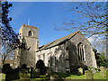
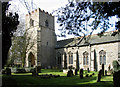
Colkirk St Mary the Virgin's church
The south tower also serves as a porch.
Image: © Adrian S Pye
Taken: 4 Mar 2010
0.05 miles
2
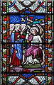
St Mary, Colkirk, Norfolk - Window detail
Resurrection
Image: © John Salmon
Taken: 22 Apr 2006
0.07 miles
6
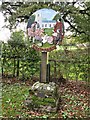
Colkirk Village Sign
Colkirk is a small village about 2½ miles south of Fakenham.
This village sign was dedicated on the millennium gala day 24th June 2000.
Image: © G Laird
Taken: 26 Oct 2017
0.10 miles
7
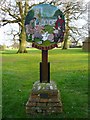
Village Sign
The village sign at Colkirk, Norfolk. The sign has a plaque that reads.... This sign was dedicated to The Millennium Gala Day 24th June 2000 by the Reverend Paul Inman to the memory of Norman Wix, Clerk to the Parish Council 1968-1995.
Image: © Craig Tuck
Taken: 19 Apr 2009
0.10 miles
8
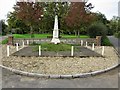
Colkirk War Memorial and Village Green
The war memorial is a tapering marble obelisk set on a grassy base at the south-east end of the village green at the fork of Church Road (left) and Market Hill (right).
Image: © G Laird
Taken: 26 Oct 2017
0.10 miles
9
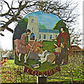
Colkirk village sign
The sign is a picture of mediaeval life with the church of St Mary in the background, presumably things have moved on since. https://www.geograph.org.uk/photo/6793629
Image: © Adrian S Pye
Taken: 31 Mar 2021
0.11 miles
10
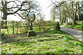
Colkirk village sign
The sign is a picture of mediaeval life with the church of St Mary in the background, presumably things have moved on since. https://www.geograph.org.uk/photo/6793628
Image: © Adrian S Pye
Taken: 31 Mar 2021
0.11 miles