IMAGES TAKEN NEAR TO
Heath Road, FAKENHAM, NR21 7DP
Introduction
This page details the photographs taken nearby to Heath Road, NR21 7DP by members of the Geograph project.
The Geograph project started in 2005 with the aim of publishing, organising and preserving representative images for every square kilometre of Great Britain, Ireland and the Isle of Man.

There are currently over 7.5m images from over14,400 individuals and you can help contribute to the project by visiting https://www.geograph.org.uk
Image Map
Images are licensed for reuse under creativecommons.org/licenses/by-sa/2.0
Notes
- Clicking on the map will re-center to the selected point.
- The higher the marker number, the further away the image location is from the centre of the postcode.
Image Listing (15 Images Found)
Images are licensed for reuse under creativecommons.org/licenses/by-sa/2.0
Image
Details
Distance
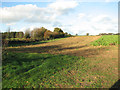
1
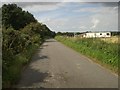
Caravan with recently completed poultry unit beyond
To the left Kipton Heath and Gravelpit Wood straight ahead.
Image: © Nigel Jones
Taken: 17 Aug 2007
0.04 miles
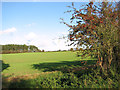
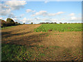
4
Kipton Heath Wood
Coniferous plan at Kipton Heath
Image: © P Gaskell
Taken: Unknown
0.17 miles