
IMAGES TAKEN NEAR TO
The Old Appleyard, FAKENHAM, NR21 0DS
Introduction
This page details the photographs taken nearby to The Old Appleyard, NR21 0DS by members of the Geograph project.
The Geograph project started in 2005 with the aim of publishing, organising and preserving representative images for every square kilometre of Great Britain, Ireland and the Isle of Man.

There are currently over 7.5m images from over14,400 individuals and you can help contribute to the project by visiting https://www.geograph.org.uk
Image Map
Images are licensed for reuse under creativecommons.org/licenses/by-sa/2.0
Notes
- Clicking on the map will re-center to the selected point.
- The higher the marker number, the further away the image location is from the centre of the postcode.
Image Listing (85 Images Found)
Images are licensed for reuse under creativecommons.org/licenses/by-sa/2.0
Image
Details
Distance
1
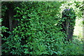
Old Buffer Stops
Old Buffer stops south of Great Rybourgh station, for an old siding.
The Trackbed north of County School to Fakenham Gas Museum (including M&GN trackbed) is in private hands but protected from development. The major obstacle being Great Ryburgh Maltings, being built on the trackbed.
Image: © Ashley Dace
Taken: 3 Jun 2010
0.04 miles
2
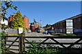
View of Great Ryburgh Station Site
This is the site of the level crossing with the station. The original station house is to the extreme left, now a private residence. The platform behind the white sign. Crisps maltings have expanded onto the trackbed since closure, this is a major obstacle for the Mid Norfolk Railway extension to Fakenham.
Image: © Ashley Dace
Taken: 3 Jun 2010
0.04 miles
3
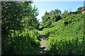
Looking South of Great Ryburgh
The cutting south of the railway station, looking to Dereham. Now very overgrown an unofficial footpath runs through.
Image: © Ashley Dace
Taken: 3 Jun 2010
0.04 miles
5
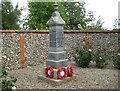
War Memorial, Great Ryburgh
Listed Grade II https://historicengland.org.uk/listing/the-list/list-entry/1452673?section=official-list-entry
Image: © Jonathan Thacker
Taken: 6 Sep 2022
0.05 miles
6
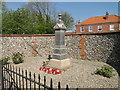
War Memorial at Great Ryburgh
The Memorial bears the names of men from three villages, Great and Little Ryburgh and Testerton.
Image: © Adrian S Pye
Taken: 8 May 2016
0.06 miles
7
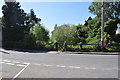
Site of Great Ryburgh Level Crossing
The signal box was a full wooden one and was situated on the right behind the fence.
Image: © Ashley Dace
Taken: 3 Jun 2010
0.06 miles
9
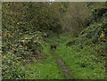
Muntjac deer on the disused railway line, Great Ryburgh
This deer can be seen in context in Image
Image: © habiloid
Taken: 1 Nov 2024
0.06 miles
10
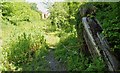
Buffer Stops at Great Ryburgh
A view of old wooden buffer stops at the end of a long gone siding. The Trackbed north of County School to Fakenham Gas Museum (including M&GN trackbed) is in private hands but protected from development. The major obstacle being Great Ryburgh Maltings, being built on the trackbed.
Image: © Ashley Dace
Taken: 3 Jun 2010
0.06 miles