
IMAGES TAKEN NEAR TO
Field Dalling Road, FAKENHAM, NR21 0DE
Introduction
This page details the photographs taken nearby to Field Dalling Road, NR21 0DE by members of the Geograph project.
The Geograph project started in 2005 with the aim of publishing, organising and preserving representative images for every square kilometre of Great Britain, Ireland and the Isle of Man.

There are currently over 7.5m images from over14,400 individuals and you can help contribute to the project by visiting https://www.geograph.org.uk
Image Map
Images are licensed for reuse under creativecommons.org/licenses/by-sa/2.0
Notes
- Clicking on the map will re-center to the selected point.
- The higher the marker number, the further away the image location is from the centre of the postcode.
Image Listing (69 Images Found)
Images are licensed for reuse under creativecommons.org/licenses/by-sa/2.0
Image
Details
Distance
1
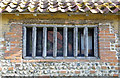
Old window
Wood-mullioned window in the wall of the old cottage attached to Binham Manor Farmhouse Image
Image: © M H Evans
Taken: 21 May 2019
0.00 miles
2
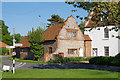
Dutch gabled cottage
This brick and flint walled cottage is attached to Binham Manor Farm.
Image: © M H Evans
Taken: 21 May 2019
0.01 miles
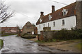
4
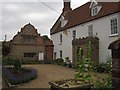
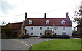
Binham: Manor Farm and its pretty dutch-gabled cottage
Image: © Keith Salvesen
Taken: 7 Jul 2010
0.02 miles
5
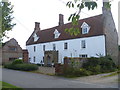
Manor Farmhouse
The 17th century house has an interesting contemporary 1½ storey annex with an elaborate Dutch gable. Listed, grade II, with details at: https://www.historicengland.org.uk/listing/the-list/list-entry/1049508
Image: © Michael Dibb
Taken: 5 Sep 2016
0.02 miles
7
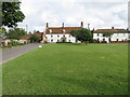
Back Street, Binham
View across the green.
Image: © Pauline E
Taken: 14 Jun 2014
0.03 miles
8
![Binham Cross [2]](https://s1.geograph.org.uk/geophotos/05/13/35/5133553_a4439828_120x120.jpg)
Binham Cross [2]
The base and shaft remain from the 15th century cross. Following the granting of a charter by Henry I, an annual fair and a weekly market were held here, and fairs continued to be held until the early 1950s. Listed, grade II, with details at: https://www.historicengland.org.uk/listing/the-list/list-entry/1170757
Also a scheduled ancient monument with additional details at: https://www.historicengland.org.uk/listing/the-list/list-entry/1013571
Image: © Michael Dibb
Taken: 5 Sep 2016
0.04 miles
9

Binham Wayside Cross
The cross was built in the 15th century by the monks of nearby Binham Priory. Originally it had a stone cross at the top of the shaft. Binham Cross was probably intended as a focus for local activities such as outdoor preaching.
Image: © G Laird
Taken: 19 Jun 2014
0.04 miles
10
![Binham Cross [1]](https://s0.geograph.org.uk/geophotos/05/13/35/5133552_7c5aae9c_120x120.jpg)
Binham Cross [1]
The base and shaft remain from the 15th century cross. Following the granting of a charter by Henry I, an annual fair and a weekly market were held here, and fairs continued to be held until the early 1950s. Listed, grade II, with details at: https://www.historicengland.org.uk/listing/the-list/list-entry/1170757
Also a scheduled ancient monument with additional details at: https://www.historicengland.org.uk/listing/the-list/list-entry/1013571
Image: © Michael Dibb
Taken: 5 Sep 2016
0.04 miles