
IMAGES TAKEN NEAR TO
Claypit Road, DEREHAM, NR20 5RW
Introduction
This page details the photographs taken nearby to Claypit Road, NR20 5RW by members of the Geograph project.
The Geograph project started in 2005 with the aim of publishing, organising and preserving representative images for every square kilometre of Great Britain, Ireland and the Isle of Man.

There are currently over 7.5m images from over14,400 individuals and you can help contribute to the project by visiting https://www.geograph.org.uk
Image Map
Images are licensed for reuse under creativecommons.org/licenses/by-sa/2.0
Notes
- Clicking on the map will re-center to the selected point.
- The higher the marker number, the further away the image location is from the centre of the postcode.
Image Listing (62 Images Found)
Images are licensed for reuse under creativecommons.org/licenses/by-sa/2.0
Image
Details
Distance
2

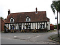
The New Frost Hall
For a view of the old village hall/reading room see > Image
Image: © Evelyn Simak
Taken: 29 Sep 2007
0.05 miles
3
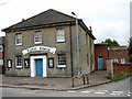
Foulsham Baptist Church
For more information on this church, which was built in 1826, see http://www.norfolkchurches.co.uk/foulshambaptist/foulshambaptist.htm
Image: © Evelyn Simak
Taken: 29 Sep 2007
0.05 miles
4
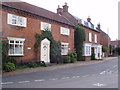
One by the road!
No guesses for knowing what this elegant house was in former times! The Old Bull Inn was once a favourite watering hole in the village of Foulsham.
Image: © David Williams
Taken: 30 Aug 2006
0.06 miles
7
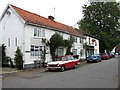
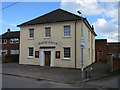
Cottages and Post Office in Station Road
Image: © Evelyn Simak
Taken: 29 Sep 2007
0.08 miles
8

New Frost Hall, Foulsham Village Hall
Off Claypit Road
Image: © Geographer
Taken: 11 May 2011
0.08 miles
9

New Frost Hall, Foulsham Village Hall
Off Claypit Road
Image: © Geographer
Taken: 11 May 2011
0.08 miles
10

Clay Pitts Road
Looking towards Pockthorpe at the junction with Low Common Close
Image: © Geographer
Taken: 11 May 2011
0.08 miles