
IMAGES TAKEN NEAR TO
Bintree, DEREHAM, NR20 5ND
Introduction
This page details the photographs taken nearby to NR20 5ND by members of the Geograph project.
The Geograph project started in 2005 with the aim of publishing, organising and preserving representative images for every square kilometre of Great Britain, Ireland and the Isle of Man.

There are currently over 7.5m images from over14,400 individuals and you can help contribute to the project by visiting https://www.geograph.org.uk
Image Map
Images are licensed for reuse under creativecommons.org/licenses/by-sa/2.0
Notes
- Clicking on the map will re-center to the selected point.
- The higher the marker number, the further away the image location is from the centre of the postcode.
Image Listing (53 Images Found)
Images are licensed for reuse under creativecommons.org/licenses/by-sa/2.0
Image
Details
Distance
1

Village sign
The village sign is located on the green between The Street and the A1067 (Fakenham Road); the latter can be seen through the trees. The sign depicts St Swithin's, the parish church of Bintree > http://www.geograph.org.uk/photo/893331.
Image: © Evelyn Simak
Taken: 22 Jul 2008
0.04 miles
2
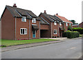
New Houses on The Street
A mixture of old and new houses and cottages line The Street, the main thoroughfare through the village of Bintree.
Image: © Evelyn Simak
Taken: 22 Jul 2008
0.04 miles

4
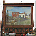
Bintree village sign (north face)
A double-sided sign, on this side and a picture of the mill on the River Wensum, and miller’s house, thought to date from the 1750s, with a nice watercolour of Bintree St Swithin’s church, on the other.
The watermill is thought to have stood at this location since 1454 when the name of the village was spelt 'Bintry' and the mill has therefore always been known as Bintry Mill.
https://www.geograph.org.uk/photo/6688636 https://www.geograph.org.uk/photo/6688637
Image: © Adrian S Pye
Taken: 3 Apr 2021
0.06 miles
5
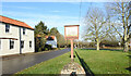
Bintree village sign
A nice watercolour of Bintree church, but nothing about the parish.
https://www.geograph.org.uk/photo/6688636
Image: © Adrian S Pye
Taken: 26 Nov 2020
0.06 miles
6

Bintree village sign
A double sided sign with a nice watercolour of Bintree St Swithin’s church, on the other side and a picture of the mill on the River Wensum, and miller’s house, thought to date from the 1750s. https://www.geograph.org.uk/photo/6796366
https://www.geograph.org.uk/photo/6688637
Image: © Adrian S Pye
Taken: 26 Nov 2020
0.06 miles
8
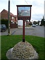
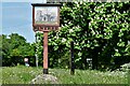
Village Sign
The village sign at Bintree, Norfolk
Image: © Craig Tuck
Taken: 5 Apr 2009
0.06 miles
10
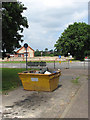
A yellow skip
Parked at the dead-end of a road by the village green. The road seen beyond the railings is the A1087 (Fakenham Road), with the Bintree & Twyford village hall on the other side.
Image: © Evelyn Simak
Taken: 22 Jul 2008
0.06 miles