
IMAGES TAKEN NEAR TO
Twyford, DEREHAM, NR20 5LY
Introduction
This page details the photographs taken nearby to NR20 5LY by members of the Geograph project.
The Geograph project started in 2005 with the aim of publishing, organising and preserving representative images for every square kilometre of Great Britain, Ireland and the Isle of Man.

There are currently over 7.5m images from over14,400 individuals and you can help contribute to the project by visiting https://www.geograph.org.uk
Image Map
Images are licensed for reuse under creativecommons.org/licenses/by-sa/2.0
Notes
- Clicking on the map will re-center to the selected point.
- The higher the marker number, the further away the image location is from the centre of the postcode.
Image Listing (31 Images Found)
Images are licensed for reuse under creativecommons.org/licenses/by-sa/2.0
Image
Details
Distance
1
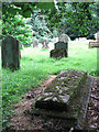
St Nicholas' church - churchyard
Although St Nicholas' is situated right beside the busy A1067, nothing indicates that this is the location of a church; the surrounding brick wall and tall trees rather look as if they were forming the boundary of a manor, which in a way they are, because Twyford Manor is adjoining the church in the east and can be reached via a footpath from the churchyard > http://www.geograph.org.uk/photo/893723. St Nicholas' church > http://www.geograph.org.uk/photo/893712 - http://www.geograph.org.uk/photo/893726 - http://www.geograph.org.uk/photo/893735 is built of flint conglomerate, brick and limestone; the red-brick porch tower > http://www.geograph.org.uk/photo/893714 - too short to give away the church's presence from a distance - is topped by an ornate bell cupola and dated to 1732. The nave is what remains of a Saxon or Norman church building, the chancel was added in the 13th century. There was an extensive restoration in the 19th century and the rood screen > http://www.geograph.org.uk/photo/893731 dates from that time, as does the carved alabaster reredos > http://www.geograph.org.uk/photo/893734. The stained glass east window > http://www.geograph.org.uk/photo/893733 is early 20th century. Older survivals are the C13 font > http://www.geograph.org.uk/photo/893736 and the ribbed, three-centred wooden south door. Fragments of medieval stained glass were reset into one of the nave north windows > http://www.geograph.org.uk/photo/893728. The church is kept locked but a key is available at request. For more information see: http://www.norfolkchurches.co.uk/twyford/twyford.htm
Image: © Evelyn Simak
Taken: 22 Jul 2008
0.04 miles
2
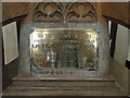
War Memorial at Twyford
The Memorial to which this plaque is attached is the font cover which can be seen here http://www.geograph.org.uk/photo/893736
Image: © Adrian S Pye
Taken: 8 May 2016
0.04 miles
3
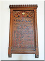
Twyford War Memorial and Roll of Honour
The names of those who served are surmounted by the only loss. His memorial is the font cover.
Image: © Adrian S Pye
Taken: 8 May 2016
0.04 miles
4
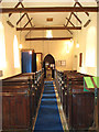
St Nicholas' church - view west
Although St Nicholas' is situated right beside the busy A1067, nothing indicates that this is the location of a church; the surrounding brick wall and tall trees rather look as if they were forming the boundary of a manor, which in a way they are, because Twyford Manor is adjoining the church in the east and can be reached via a footpath from the churchyard > http://www.geograph.org.uk/photo/893723. St Nicholas' church > http://www.geograph.org.uk/photo/893712 - http://www.geograph.org.uk/photo/893726 is built of flint conglomerate, brick and limestone; the red-brick porch tower > http://www.geograph.org.uk/photo/893714 - too short to give away the church's presence from a distance - is topped by an ornate bell cupola and dated to 1732. The nave is what remains of a Saxon or Norman church building, the chancel was added in the 13th century. There was an extensive restoration in the 19th century and the rood screen > http://www.geograph.org.uk/photo/893731 dates from that time, as does the carved alabaster reredos > http://www.geograph.org.uk/photo/893734. The stained glass east window > http://www.geograph.org.uk/photo/893733 is early 20th century. Older survivals are the C13 font > http://www.geograph.org.uk/photo/893736 and the ribbed, three-centred wooden south door. Fragments of medieval stained glass were reset into one of the nave north windows > http://www.geograph.org.uk/photo/893728. The church is kept locked but a key is available at request. For more information see: http://www.norfolkchurches.co.uk/twyford/twyford.htm
Image: © Evelyn Simak
Taken: 22 Jul 2008
0.05 miles
5
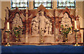
St Nicholas' church - C 19 reredos
Although St Nicholas' is situated right beside the busy A1067, nothing indicates that this is the location of a church; the surrounding brick wall and tall trees rather look as if they were forming the boundary of a manor, which in a way they are, because Twyford Manor is adjoining the church in the east and can be reached via a footpath from the churchyard > http://www.geograph.org.uk/photo/893723. St Nicholas' church > http://www.geograph.org.uk/photo/893712 - http://www.geograph.org.uk/photo/893726 - http://www.geograph.org.uk/photo/893735 is built of flint conglomerate, brick and limestone; the red-brick porch tower > http://www.geograph.org.uk/photo/893714 - too short to give away the church's presence from a distance - is topped by an ornate bell cupola and dated to 1732. The nave is what remains of a Saxon or Norman church building, the chancel was added in the 13th century. There was an extensive restoration in the 19th century and the rood screen > http://www.geograph.org.uk/photo/893731 dates from that time, as does the carved alabaster reredos (seen here). The stained glass east window > http://www.geograph.org.uk/photo/893733 is early 20th century. Older survivals are the C13 font > http://www.geograph.org.uk/photo/893736 and the ribbed, three-centred wooden south door. Fragments of medieval stained glass were reset into one of the nave north windows > http://www.geograph.org.uk/photo/893728. The church is kept locked but a key is available at request. For more information see: http://www.norfolkchurches.co.uk/twyford/twyford.htm
Image: © Evelyn Simak
Taken: 22 Jul 2008
0.05 miles
6
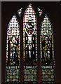
St Nicholas' church - east window
Although St Nicholas' is situated right beside the busy A1067, nothing indicates that this is the location of a church; the surrounding brick wall and tall trees rather look as if they were forming the boundary of a manor, which in a way they are, because Twyford Manor is adjoining the church in the east and can be reached via a footpath from the churchyard > http://www.geograph.org.uk/photo/893723. St Nicholas' church > http://www.geograph.org.uk/photo/893712 - http://www.geograph.org.uk/photo/893726 - http://www.geograph.org.uk/photo/893735 is built of flint conglomerate, brick and limestone; the red-brick porch tower > http://www.geograph.org.uk/photo/893714 - too short to give away the church's presence from a distance - is topped by an ornate bell cupola and dated to 1732. The nave is what remains of a Saxon or Norman church building, the chancel was added in the 13th century. There was an extensive restoration in the 19th century and the rood screen > http://www.geograph.org.uk/photo/893731 dates from that time, as does the carved alabaster reredos > http://www.geograph.org.uk/photo/893734. The stained glass east window (seen here) is early 20th century. Older survivals are the C13 font > http://www.geograph.org.uk/photo/893736 and the ribbed, three-centred wooden south door. Fragments of medieval stained glass were reset into one of the nave north windows > http://www.geograph.org.uk/photo/893728. The church is kept locked but a key is available at request. For more information see: http://www.norfolkchurches.co.uk/twyford/twyford.htm
Image: © Evelyn Simak
Taken: 22 Jul 2008
0.05 miles
7
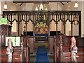
St Nicholas' church - C19 rood screen
Although St Nicholas' is situated right beside the busy A1067, nothing indicates that this is the location of a church; the surrounding brick wall and tall trees rather look as if they were forming the boundary of a manor, which in a way they are, because Twyford Manor is adjoining the church in the east and can be reached via a footpath from the churchyard > http://www.geograph.org.uk/photo/893723. St Nicholas' church > http://www.geograph.org.uk/photo/893712 - http://www.geograph.org.uk/photo/893726 - http://www.geograph.org.uk/photo/893735 is built of flint conglomerate, brick and limestone; the red-brick porch tower > http://www.geograph.org.uk/photo/893714 - too short to give away the church's presence from a distance - is topped by an ornate bell cupola and dated to 1732. The nave is what remains of a Saxon or Norman church building, the chancel was added in the 13th century. There was an extensive restoration in the 19th century and the rood screen (seen here) dates from that time, as does the carved alabaster reredos > http://www.geograph.org.uk/photo/893734. The stained glass east window > http://www.geograph.org.uk/photo/893733 is early 20th century. Older survivals are the C13 font > http://www.geograph.org.uk/photo/893736 and the ribbed, three-centred wooden south door. Fragments of medieval stained glass were reset into one of the nave north windows > http://www.geograph.org.uk/photo/893728. The church is kept locked but a key is available at request. For more information see: http://www.norfolkchurches.co.uk/twyford/twyford.htm
Image: © Evelyn Simak
Taken: 22 Jul 2008
0.05 miles
8
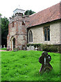
St Nicholas' church - tomb chests by south wall
Although St Nicholas' is situated right beside the busy A1067, nothing indicates that this is the location of a church; the surrounding brick wall and tall trees rather look as if they were forming the boundary of a manor, which in a way they are, because Twyford Manor is adjoining the church in the east and can be reached via a footpath from the churchyard > http://www.geograph.org.uk/photo/893723. St Nicholas' church > http://www.geograph.org.uk/photo/893712 - http://www.geograph.org.uk/photo/893726 - http://www.geograph.org.uk/photo/893735 is built of flint conglomerate, brick and limestone; the red-brick porch tower > http://www.geograph.org.uk/photo/893714 - too short to give away the church's presence from a distance - is topped by an ornate bell cupola and dated to 1732. The nave is what remains of a Saxon or Norman church building, the chancel was added in the 13th century. There was an extensive restoration in the 19th century and the rood screen > http://www.geograph.org.uk/photo/893731 dates from that time, as does the carved alabaster reredos > http://www.geograph.org.uk/photo/893734. The stained glass east window > http://www.geograph.org.uk/photo/893733 is early 20th century. Older survivals are the C13 font > http://www.geograph.org.uk/photo/893736 and the ribbed, three-centred wooden south door. Fragments of medieval stained glass were reset into one of the nave north windows > http://www.geograph.org.uk/photo/893728. The church is kept locked but a key is available at request. For more information see: http://www.norfolkchurches.co.uk/twyford/twyford.htm
Image: © Evelyn Simak
Taken: 22 Jul 2008
0.05 miles
9
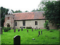
St Nicholas' church
Although St Nicholas' is situated right beside the busy A1067, nothing indicates that this is the location of a church; the surrounding brick wall and tall trees rather look as if they were forming the boundary of a manor, which in a way they are, because Twyford Manor is adjoining the church in the east and can be reached via a footpath from the churchyard > http://www.geograph.org.uk/photo/893723. St Nicholas' church > http://www.geograph.org.uk/photo/893712 - http://www.geograph.org.uk/photo/893726 - http://www.geograph.org.uk/photo/893735 is built of flint conglomerate, brick and limestone; the red-brick porch tower > http://www.geograph.org.uk/photo/893714 - too short to give away the church's presence from a distance - is topped by an ornate bell cupola and dated to 1732. The nave is what remains of a Saxon or Norman church building, the chancel was added in the 13th century. There was an extensive restoration in the 19th century and the rood screen > http://www.geograph.org.uk/photo/893731 dates from that time, as does the carved alabaster reredos > http://www.geograph.org.uk/photo/893734. The stained glass east window > http://www.geograph.org.uk/photo/893733 is early 20th century. Older survivals are the C13 font > http://www.geograph.org.uk/photo/893736 and the ribbed, three-centred wooden south door. Fragments of medieval stained glass were reset into one of the nave north windows > http://www.geograph.org.uk/photo/893728. The church is kept locked but a key is available at request. For more information see: http://www.norfolkchurches.co.uk/twyford/twyford.htm
Image: © Evelyn Simak
Taken: 22 Jul 2008
0.05 miles
10
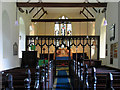
St Nicholas, Twyford, Norfolk - East end
Image: © John Salmon
Taken: 24 Jun 2006
0.05 miles