
IMAGES TAKEN NEAR TO
Turnpike Close, DEREHAM, NR20 4ST
Introduction
This page details the photographs taken nearby to Turnpike Close, NR20 4ST by members of the Geograph project.
The Geograph project started in 2005 with the aim of publishing, organising and preserving representative images for every square kilometre of Great Britain, Ireland and the Isle of Man.

There are currently over 7.5m images from over14,400 individuals and you can help contribute to the project by visiting https://www.geograph.org.uk
Image Map
Images are licensed for reuse under creativecommons.org/licenses/by-sa/2.0
Notes
- Clicking on the map will re-center to the selected point.
- The higher the marker number, the further away the image location is from the centre of the postcode.
Image Listing (74 Images Found)
Images are licensed for reuse under creativecommons.org/licenses/by-sa/2.0
Image
Details
Distance
1
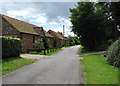
Converted barns
Beside Chapel Road (West).
Image: © Evelyn Simak
Taken: 19 Jul 2008
0.03 miles
2
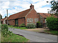
Chapel Barn
A converted barn on Chapel Road (West).
Image: © Evelyn Simak
Taken: 19 Jul 2008
0.05 miles
3
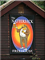
The Natterjack - pub sign
See also > http://www.geograph.org.uk/photo/889921.
Image: © Evelyn Simak
Taken: 19 Jul 2008
0.06 miles
4
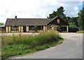
The Natterjack
A Freehouse in the western part of the village of Foxley, set back from Chapel Road (West). For a view of the pub sign see > http://www.geograph.org.uk/photo/889924.
Image: © Evelyn Simak
Taken: 19 Jul 2008
0.07 miles
5
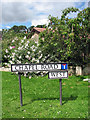
Road sign for Chapel Road (West)
By the junction with the Old Fakenham Road, in the western part of the village of Foxley which was split in two sections when the A1067 (Norwich Road) was built in the 1990s. For a view of Chapel Road east of the A1067 see > http://www.geograph.org.uk/photo/889170.
Image: © Evelyn Simak
Taken: 19 Jul 2008
0.07 miles
6
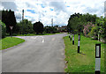
Approaching the Old Fakenham Road
From Chapel Road (West); the road beyond is Mill Road. The village of Foxley was split into two sections when the A1067 (Norwich Road) was built in the 1990s. For a view of Chapel Road east of the A1067 see > http://www.geograph.org.uk/photo/889170.
Image: © Evelyn Simak
Taken: 19 Jul 2008
0.07 miles
7
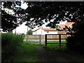
The end of Chapel Road (West)
View towards the A1067 and houses on the other side. The village of Foxley was split into two parts when the A1067 (Norwich Road) was built in the 1990s. For a view of the continuation of Chapel Road further east see > http://www.geograph.org.uk/photo/889170.
Image: © Evelyn Simak
Taken: 19 Jul 2008
0.07 miles
8

Old Fakenham Road reconnects with the A1067
The Old Fakenham Road doglegs through the western part of the village of Foxley, which was split into two sections when the A1067 (Norwich Road) was built in the 1990s. What is now called Old Fakenham Road used to be the old road from Norwich to Fakenham; it now turns off the A1067 only to reconnect with it a short distance further south (or north, depending which way one is travelling).
Image: © Evelyn Simak
Taken: 19 Jul 2008
0.07 miles
9
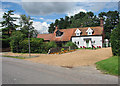
Cottages beside the Old Fakenham Road
Through Foxley. The Old Fakenham Road doglegs through the western part of the village of Foxley, which was split into two sections when the A1067 (Norwich Road) was built in the 1990s. What is now called Old Fakenham Road used to be the old road from Norwich to Fakenham; it now turns off the A1067 only to reconnect with it a short distance further south (or north, depending which way one is travelling).
Image: © Evelyn Simak
Taken: 19 Jul 2008
0.10 miles
10

Primitive Methodist Chapel
In Chapel Road. This chapel was built in 1898 and has since then been converted into a holiday home.
Image: © Evelyn Simak
Taken: 19 Jul 2008
0.10 miles