IMAGES TAKEN NEAR TO
Bell Close, DEREHAM, NR20 4SL
Introduction
This page details the photographs taken nearby to Bell Close, NR20 4SL by members of the Geograph project.
The Geograph project started in 2005 with the aim of publishing, organising and preserving representative images for every square kilometre of Great Britain, Ireland and the Isle of Man.

There are currently over 7.5m images from over14,400 individuals and you can help contribute to the project by visiting https://www.geograph.org.uk
Image Map
Images are licensed for reuse under creativecommons.org/licenses/by-sa/2.0
Notes
- Clicking on the map will re-center to the selected point.
- The higher the marker number, the further away the image location is from the centre of the postcode.
Image Listing (48 Images Found)
Images are licensed for reuse under creativecommons.org/licenses/by-sa/2.0
Image
Details
Distance
1

Old Toll House, Bawdeswell
Toll House in the parish of Bawdeswell; the tollhouse was derelict in 1980 but is now renovated. It is on Norwich Road (B1145) opposite its junction with Hall Road.
To be surveyed
Milestone Society National ID: NO.BAW
Image: © Milestone Society
Taken: Unknown
0.09 miles
2
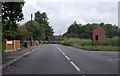
Norwich Road, Bawdeswell
This is the B1145.
Image: © J.Hannan-Briggs
Taken: 14 Jun 2016
0.14 miles
3
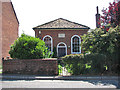
Wesleyan Chapel
This Wesleyan chapel is located on The Street. Built in 1829 it has since been converted into a private dwelling house.
Image: © Evelyn Simak
Taken: 24 Jul 2008
0.17 miles
4
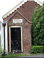
Gospel Hall - porch
Entrance porch to a tiny former Gospel Hall (disused), dating from 1903, on Paradise Road. See also > http://www.geograph.org.uk/photo/890129.
Image: © Evelyn Simak
Taken: 19 Jul 2008
0.20 miles
5
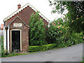
Gospel Hall
A tiny former Gospel Hall (disused), dating from 1903, on Paradise Road. See also > http://www.geograph.org.uk/photo/890132.
Image: © Evelyn Simak
Taken: 19 Jul 2008
0.20 miles
6
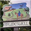
Bawdeswell village sign repainted
The sign is fairly self explanatory with Balder's Well shown being approached on horseback by Geoffrey Chaucer's reeve, from his Canterbury Tales.
The background is an agricultural landscape and the church half hidden by the tree.
The mosquito depicted represents XX, KB364 6T-P, 608 Sqdn, out of Downham Market which crashed onto the church on the 6th November 1944 destroying it completely.
The pilot, Pilot Officer, James McLEAN, and Navigator Sgt. Mervyn Lambert TANSLEY were both killed. A memorial made from part of the aircraft is displayed in the church which was rebuilt.
The aircraft was returning from an operational sortie over Gelsenkirchen, and probably crashed due to excessive icing.
Image: © Jane Rackham
Taken: 3 Jun 2022
0.20 miles
7
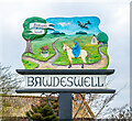
Bawdeswell village sign
The sign is fairly self explanatory with Balder's Well shown being approached on horseback by Geoffrey Chaucer's reeve, from his Canterbury Tales.
The background is an agricultural landscape and the church half hidden by the tree.
The mosquito depicted represents XX, KB364 6T-P, 608 Sqdn, out of Downham Market which crashed onto the church on the 6th November 1944 destroying it completely.
The pilot, Pilot Officer, James McLEAN, and Navigator Sgt. Mervyn Lambert TANSLEY were both killed. A memorial made from part of the aircraft is displayed in the church which was rebuilt.
The aircraft was returning from an operational sortie over Gelsenkirchen, and probably crashed due to excessive icing.
Image: © Adrian S Pye
Taken: 28 Jan 2020
0.20 miles
8
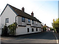
The Street in Bawdeswell
This old house stands diagonally opposite All Saints church > Image
Image: © Evelyn Simak
Taken: 6 Nov 2007
0.20 miles
9
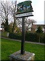
Village Sign
The village sign at Bawdeswell, Norfolk
Image: © Craig Tuck
Taken: 5 Apr 2009
0.20 miles