
IMAGES TAKEN NEAR TO
Bawdeswell, DEREHAM, NR20 4RR
Introduction
This page details the photographs taken nearby to NR20 4RR by members of the Geograph project.
The Geograph project started in 2005 with the aim of publishing, organising and preserving representative images for every square kilometre of Great Britain, Ireland and the Isle of Man.

There are currently over 7.5m images from over14,400 individuals and you can help contribute to the project by visiting https://www.geograph.org.uk
Image Map
Images are licensed for reuse under creativecommons.org/licenses/by-sa/2.0
Notes
- Clicking on the map will re-center to the selected point.
- The higher the marker number, the further away the image location is from the centre of the postcode.
Image Listing (54 Images Found)
Images are licensed for reuse under creativecommons.org/licenses/by-sa/2.0
Image
Details
Distance
1
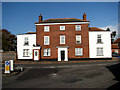
The former Bell Inn
The Bell Inn was once a Georgian coaching inn, which in 1823 became a stageing post on the Norwich to Fakenham turnpike. After its closure in 1970, the building and the adjoining stables were converted into flats.
Image: © Evelyn Simak
Taken: 6 Nov 2007
0.03 miles
2
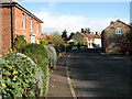
Heading northeast
... past cottages on The Street.
Image: © Evelyn Simak
Taken: 6 Nov 2007
0.05 miles
3
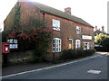
Post Box and Family Butchers Shop in The Street
Image: © Evelyn Simak
Taken: 6 Nov 2007
0.05 miles
4

Denver House, Bawdeswell
Showing position of Postbox No. NR20 2035.
See Image] for postbox.
Image: © JThomas
Taken: 2 Jun 2025
0.05 miles
5

Elizabeth II postbox on The Street, Bawdeswell
Postbox No. NR20 2035.
See Image] for context.
Image: © JThomas
Taken: 2 Jun 2025
0.05 miles
6
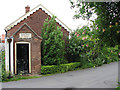
Gospel Hall
A tiny former Gospel Hall (disused), dating from 1903, on Paradise Road. See also > http://www.geograph.org.uk/photo/890132.
Image: © Evelyn Simak
Taken: 19 Jul 2008
0.07 miles
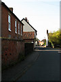
8

Old Milepost by Foxley Road, Bawdeswell parish
Cast iron post by the UC road, in parish of Bawdeswell (Breckland District), 70yds South of Bawdeswell Primary School, in hedge at back of verge, on West side of road. Fakenham cast iron N-top, erected by the Norwich & Fakenham turnpike trust in the 19th century.
Inscription reads:-
: FAKENHAM / 10 : : TO / NORWICH / 14 / MILES : : BAWDESWELL / 14 :
Norfolk HER.
NHER Number: 56418 https://www.heritagegateway.org.uk/Gateway/Results_Single.aspx?uid=MNF62824&resourceID=1002
Milestone Society National ID: NO_NF14
Image: © CW Haines
Taken: 24 Jan 2003
0.07 miles
9
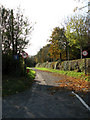
Dereham Road
This section of the Dereham Road is now a cul-de-sac, separated from the B1147 (Dereham Road) since the construction of the A1067 (Norwich Road), which now bisects it.
Image: © Evelyn Simak
Taken: 6 Nov 2007
0.07 miles
10
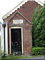
Gospel Hall - porch
Entrance porch to a tiny former Gospel Hall (disused), dating from 1903, on Paradise Road. See also > http://www.geograph.org.uk/photo/890129.
Image: © Evelyn Simak
Taken: 19 Jul 2008
0.07 miles