
IMAGES TAKEN NEAR TO
Ashley Road, DEREHAM, NR20 4BS
Introduction
This page details the photographs taken nearby to Ashley Road, NR20 4BS by members of the Geograph project.
The Geograph project started in 2005 with the aim of publishing, organising and preserving representative images for every square kilometre of Great Britain, Ireland and the Isle of Man.

There are currently over 7.5m images from over14,400 individuals and you can help contribute to the project by visiting https://www.geograph.org.uk
Image Map
Images are licensed for reuse under creativecommons.org/licenses/by-sa/2.0
Notes
- Clicking on the map will re-center to the selected point.
- The higher the marker number, the further away the image location is from the centre of the postcode.
Image Listing (20 Images Found)
Images are licensed for reuse under creativecommons.org/licenses/by-sa/2.0
Image
Details
Distance
1
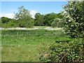
Pastures adjoining stream
The stream is obscured by the vegetation growing alongside it - the stock fence seen in mid-distance denotes its course.
Image: © Evelyn Simak
Taken: 18 May 2009
0.18 miles
2

Path following stream
The concessionary path leading through Hoe Rough > http://www.geograph.org.uk/photo/1310074 forms two loops - one runs along a stream and an adjoining meadow, the other traverses the somewhat higher ground to the east > http://www.geograph.org.uk/photo/1310231. Unimproved meadows such as these as Hoe Rough Nature Reserve are becoming increasingly rare. A number of old oak trees grow here, one of which is believed to be at least 330 years old. The rough is now continuously grazed by sheep and cattle but the crab apple trees > http://www.geograph.org.uk/photo/1310191 probably originate from the time when pigs foraged here, the seeds having originated from swill fed to them. Hoe Rough Nature Reserve is managed by the Norfolk Wildlife Trust.
Image: © Evelyn Simak
Taken: 18 May 2009
0.19 miles
3

Stream on the northern edge of Hoe Rough
The concessionary path leading through Hoe Rough > http://www.geograph.org.uk/photo/1310074 forms two loops - one runs along this stream > http://www.geograph.org.uk/photo/1310140 and an adjoining meadow, the other traverses the somewhat higher ground to the east > http://www.geograph.org.uk/photo/1310231. Unimproved meadows such as these as Hoe Rough Nature Reserve are becoming increasingly rare. A number of old oak trees grow here, one of which is believed to be at least 330 years old. The rough is now continuously grazed by sheep and cattle but the crab apple trees > http://www.geograph.org.uk/photo/1310191 probably originate from the time when pigs foraged here, the seeds having originated from swill fed to them. Hoe Rough Nature Reserve is managed by the Norfolk Wildlife Trust.
Image: © Evelyn Simak
Taken: 18 May 2009
0.19 miles
4
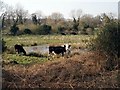
Cows graze Hoe Rough
Hoe Rough is an area of unimproved grassland and wet woodland, which is managed as a nature reserve.
Image: © Adrian Hodge
Taken: 27 Mar 2007
0.20 miles
6
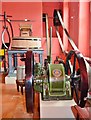
Thelveton Mill Machinery
Sadly the mill is long gone but this hurst frame and R&H diesel milling engine find themselves at Gressenhall museum.
Image]
Image]
Image: © Ashley Dace
Taken: 2 Aug 2012
0.20 miles
7

Hoe Rough Nature Reserve
The concessionary path leading through Hoe Rough > http://www.geograph.org.uk/photo/1310074 forms two loops - one runs along a stream > http://www.geograph.org.uk/photo/1310140 and an adjoining meadow, the other traverses the somewhat higher ground to the east > http://www.geograph.org.uk/photo/1310231. Unimproved meadows such as these as Hoe Rough Nature Reserve are becoming increasingly rare. A number of old oak trees grow here, one of which is believed to be at least 330 years old. The rough is now continuously grazed by sheep and cattle but the crab apple trees > http://www.geograph.org.uk/photo/1310191 probably originate from the time when pigs foraged here, the seeds having originated from swill fed to them. Hoe Rough Nature Reserve is managed by the Norfolk Wildlife Trust.
Image: © Evelyn Simak
Taken: 18 May 2009
0.21 miles
8
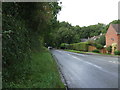
Fakenham Road, Beetley
Looking north west on the B1146.
Image: © JThomas
Taken: 16 Sep 2017
0.22 miles
9

View west along stream
This stream separates Hoe Rough (at left) from pastures adjoining on the other side.
The concessionary path leading through Hoe Rough > http://www.geograph.org.uk/photo/1310074 forms two loops - one runs along a stream > http://www.geograph.org.uk/photo/1310140 and an adjoining meadow, the other traverses the somewhat higher ground to the east > http://www.geograph.org.uk/photo/1310231. Unimproved meadows such as these as Hoe Rough Nature Reserve are becoming increasingly rare. A number of old oak trees grow here, one of which is believed to be at least 330 years old. The rough is now continuously grazed by sheep and cattle but the crab apple trees > http://www.geograph.org.uk/photo/1310191 probably originate from the time when pigs foraged here, the seeds having originated from swill fed to them. Hoe Rough Nature Reserve is managed by the Norfolk Wildlife Trust.
Image: © Evelyn Simak
Taken: 18 May 2009
0.23 miles
10
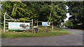
B1146 Fakenham Road at the entrance to Gressenhall Museum
Image: © Adrian S Pye
Taken: 3 Oct 2019
0.23 miles