
IMAGES TAKEN NEAR TO
Two Oaks Close, DEREHAM, NR20 4AF
Introduction
This page details the photographs taken nearby to Two Oaks Close, NR20 4AF by members of the Geograph project.
The Geograph project started in 2005 with the aim of publishing, organising and preserving representative images for every square kilometre of Great Britain, Ireland and the Isle of Man.

There are currently over 7.5m images from over14,400 individuals and you can help contribute to the project by visiting https://www.geograph.org.uk
Image Map
Images are licensed for reuse under creativecommons.org/licenses/by-sa/2.0
Notes
- Clicking on the map will re-center to the selected point.
- The higher the marker number, the further away the image location is from the centre of the postcode.
Image Listing (18 Images Found)
Images are licensed for reuse under creativecommons.org/licenses/by-sa/2.0
Image
Details
Distance
3
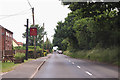
B1146 Fakenham Road
Passing The New Inn, now a Thai restaurant.
Image: © J.Hannan-Briggs
Taken: 15 Jun 2016
0.08 miles
4
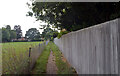
Path from High House Road to Fakenham Road, Beetley
Image: © habiloid
Taken: 23 Aug 2021
0.09 miles
5
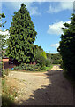
Common Drift, Beetley
Common Drift's junction with Fakenham Road (B1146) is by the telegraph pole.
Image: © habiloid
Taken: 23 Aug 2021
0.16 miles
6
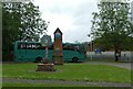
Beetley village sign and village clock, outside the school
The woodworker on the sign is seen in detail at Image
Image: © David Smith
Taken: 12 Jun 2024
0.16 miles
7
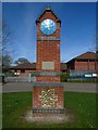
Clock
Clock near to the village sign, Beetley, Norfolk
Image: © Craig Tuck
Taken: 5 Apr 2009
0.17 miles
8
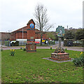
Beetley village sign and millennium clock
The sign shows a woodsman, using a wooden mallet to drive a stake into the ground. The Anglo-Saxon word for a mallet is ‘betel’, and the many hardwood trees in the area made it a good place to manufacture and produce these tools. Hence it became known as Beetley. This sign was erected for a village centenary in 1994, not quite sure what of though. https://www.geograph.org.uk/photo/6796348
Image: © Adrian S Pye
Taken: 3 Apr 2021
0.17 miles
9
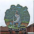
Beetley village sign
The sign shows a woodsman, using a wooden mallet to drive a stake into the ground. The Anglo-Saxon word for a mallet is ‘betel’, and the many hardwood trees in the area made it a good place to manufacture and produce these tools. Hence it became known as Beetley. This sign was erected for a village centenary in 1994, not quite sure what of though. https://www.geograph.org.uk/photo/6796350
Image: © Adrian S Pye
Taken: 3 Apr 2021
0.17 miles
10
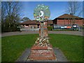
Village Sign
The village sign at Beetley, Norfolk
Image: © Craig Tuck
Taken: 5 Apr 2009
0.17 miles