
IMAGES TAKEN NEAR TO
Greenfields Road, DEREHAM, NR20 3TE
Introduction
This page details the photographs taken nearby to Greenfields Road, NR20 3TE by members of the Geograph project.
The Geograph project started in 2005 with the aim of publishing, organising and preserving representative images for every square kilometre of Great Britain, Ireland and the Isle of Man.

There are currently over 7.5m images from over14,400 individuals and you can help contribute to the project by visiting https://www.geograph.org.uk
Image Map
Images are licensed for reuse under creativecommons.org/licenses/by-sa/2.0
Notes
- Clicking on the map will re-center to the selected point.
- The higher the marker number, the further away the image location is from the centre of the postcode.
Image Listing (20 Images Found)
Images are licensed for reuse under creativecommons.org/licenses/by-sa/2.0
Image
Details
Distance
2
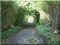
The Lane From Dereham Windmill
To the B1110.
Image: © Roger Gilbertson
Taken: 6 Nov 2006
0.22 miles
3
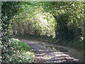
Almost At The Windmill
The track to Dereham windmill from the B1110.
Image: © Roger Gilbertson
Taken: 6 Nov 2006
0.22 miles
4
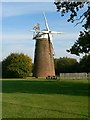
East Dereham Windmill
The grounds around the windmill are now a picnic site.
Image: © Roger Gilbertson
Taken: 5 Nov 2006
0.22 miles
5
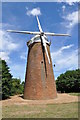
East Dereham Windmill
See http://www.norfolkmills.co.uk/Windmills/east-dereham-towermill.html This link has more information about the mill. Now set in a picnic ground at East Dereham. Sadly the future now uncertain, the mill has been boarded up and weatherproofed. A housing estate has sprug up since my last visit in the 1990s.
Image: © Ashley Dace
Taken: 10 Jul 2010
0.23 miles
6

Housing Estate at Dereham
A view of the housing estate at Dereham, the windmill which is disused can be seen in the picnic area.
Image: © Ashley Dace
Taken: 10 Jul 2010
0.24 miles

8

Dereham Windmill - Openday
The brakewheel is still in position as is the iron windshaft.
Image: © Ashley Dace
Taken: 7 Sep 2013
0.24 miles
9

Dereham Windmill - Openday
The work has seen the windows renewed making the building look far better and safer.
Image: © Ashley Dace
Taken: 7 Sep 2013
0.24 miles
10

Dereham Windmill (Former Cherry Lane Cornmill)
Probably dating from the early 19th century, Dereham Windmill is an early tower mill. No longer used as a working mill, it has now been restored and was reopened on 7th September 2013 by Dereham Town Council for the benefit of the community. It is a Grade II listed building. https://www.britishlistedbuildings.co.uk/101342709-cherry-lane-cornmill-former-dereham#.WfeSZjFLE5s
Image: © G Laird
Taken: 25 Oct 2017
0.24 miles