
IMAGES TAKEN NEAR TO
Mattishall Road, DEREHAM, NR20 3LP
Introduction
This page details the photographs taken nearby to Mattishall Road, NR20 3LP by members of the Geograph project.
The Geograph project started in 2005 with the aim of publishing, organising and preserving representative images for every square kilometre of Great Britain, Ireland and the Isle of Man.

There are currently over 7.5m images from over14,400 individuals and you can help contribute to the project by visiting https://www.geograph.org.uk
Image Map
Images are licensed for reuse under creativecommons.org/licenses/by-sa/2.0
Notes
- Clicking on the map will re-center to the selected point.
- The higher the marker number, the further away the image location is from the centre of the postcode.
Image Listing (17 Images Found)
Images are licensed for reuse under creativecommons.org/licenses/by-sa/2.0
Image
Details
Distance

2

Entering East Tuddenham
On the road from Mattishall.
Image: © Roger Gilbertson
Taken: 5 Nov 2006
0.04 miles
3

The Road To Mattishall
From East Tuddenham.
Image: © Roger Gilbertson
Taken: 5 Nov 2006
0.04 miles
4
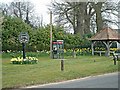
East Tuddenham Village green
The village pump was housed under the shelter to the right of the photograph
Image: © steve chamberlin
Taken: 26 Mar 2003
0.09 miles


7
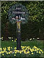
East Tuddenham Village sign
The village sign is on the village green with the phone box and pump.
Image: © steve chamberlin
Taken: 15 Mar 2007
0.13 miles
8

The village pump at East Tuddenham
Protected and boxed-in is the old village pump which has survived from the days before piped water
Image: © Adrian S Pye
Taken: 15 Dec 2014
0.14 miles
9
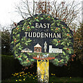
East Tuddenham village sign
The sign at East Tuddenham has an abundance of oak leaves and acorns surrounding the other notable features. From left to right is the village hall, the village pump and shelter. The figure is referring to the carved stone effigy in the church of an unknown knight holding a heart in his clasped hands. The church of All Saints. Below is a scene with a ploughman and a pair of horses representative of the farming community past and present. https://www.geograph.org.uk/photo/6796451
Image: © Adrian S Pye
Taken: 3 Apr 2021
0.15 miles
10
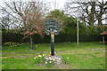
East Tuddenham village sign
The sign at East Tuddenham has an abundance of oak leaves and acorns surrounding the other notable features. From left to right is the village hall, the village pump and shelter. The figure is referring to the carved stone effigy in the church of an unknown knight holding a heart in his clasped hands. The church of All Saints. Below is a scene with a ploughman and a pair of horses representative of the farming community past and present. https://www.geograph.org.uk/photo/6796446
Image: © Adrian S Pye
Taken: 3 Apr 2021
0.15 miles