
IMAGES TAKEN NEAR TO
Bittering, DEREHAM, NR19 2QU
Introduction
This page details the photographs taken nearby to NR19 2QU by members of the Geograph project.
The Geograph project started in 2005 with the aim of publishing, organising and preserving representative images for every square kilometre of Great Britain, Ireland and the Isle of Man.

There are currently over 7.5m images from over14,400 individuals and you can help contribute to the project by visiting https://www.geograph.org.uk
Image Map
Images are licensed for reuse under creativecommons.org/licenses/by-sa/2.0
Notes
- Clicking on the map will re-center to the selected point.
- The higher the marker number, the further away the image location is from the centre of the postcode.
Image Listing (30 Images Found)
Images are licensed for reuse under creativecommons.org/licenses/by-sa/2.0
Image
Details
Distance
1

Bittering: Where Rawhall Lane joins Bittering Lane
Image: © Michael Garlick
Taken: 5 Apr 2024
0.06 miles

4
Bittering: Track to St. Peter's Church
Image: © Michael Garlick
Taken: 5 Apr 2024
0.12 miles

6

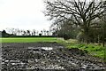
Field beside the church
This field is located beside the track leading to St Peter's church > http://www.geograph.org.uk/photo/607254. The view is southeasterly.
Image: © Evelyn Simak
Taken: 15 Aug 2008
0.14 miles
7

Stony Lane, Bittering
Part of the Nar Valley Way, this straight section of Stony Lane is probably a continuation of the Roman Road marked in square to the west.
Image: © Zorba the Geek
Taken: 11 Aug 2007
0.14 miles
8

Bittering: Detached house at the junction of Bittering Lane and Stoney Lane
Image: © Michael Garlick
Taken: 9 Jun 2019
0.15 miles

10
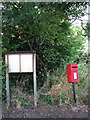
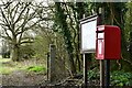
Postbox and church noticeboard
By the start of the track leading to St Peter's church > http://www.geograph.org.uk/photo/607254.
Image: © Evelyn Simak
Taken: 15 Aug 2008
0.16 miles