
IMAGES TAKEN NEAR TO
Dereham Road, DEREHAM, NR19 2PF
Introduction
This page details the photographs taken nearby to Dereham Road, NR19 2PF by members of the Geograph project.
The Geograph project started in 2005 with the aim of publishing, organising and preserving representative images for every square kilometre of Great Britain, Ireland and the Isle of Man.

There are currently over 7.5m images from over14,400 individuals and you can help contribute to the project by visiting https://www.geograph.org.uk
Image Map
Images are licensed for reuse under creativecommons.org/licenses/by-sa/2.0
Notes
- Clicking on the map will re-center to the selected point.
- The higher the marker number, the further away the image location is from the centre of the postcode.
Image Listing (33 Images Found)
Images are licensed for reuse under creativecommons.org/licenses/by-sa/2.0
Image
Details
Distance
1
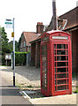
K6 telephone box on Dereham Road, Scarning
For a wider view of this location see > http://www.geograph.org.uk/photo/2050092.
Image: © Evelyn Simak
Taken: 1 Sep 2010
0.02 miles
2
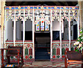
The church of SS Peter and Paul in Scarning - C15 rood screen
The church of SS Peter and Paul > http://www.geograph.org.uk/photo/2050111 is situated in the heart of the village, beside Dereham Road, the main thoroughfare through Scarning. Its oldest part, the base of the tower, dates from the 12th century but the church as we see it today dates mainly from the 14th and 15th centuries. There was an extensive restoration in the 19th century. The treasure of the church is the fine 13th century baptismal font > http://www.geograph.org.uk/photo/2050126 which has a Jacobean cover that can be raised and lowered by a system of counter-weights. The rood screen dates from the 15th century. The east window > http://www.geograph.org.uk/photo/2050120 was installed in 1870.
Image: © Evelyn Simak
Taken: 1 Sep 2010
0.04 miles
3
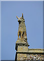
A bull on a church tower
The statuette of a bull sits on the southwest corner of Scarning church tower. Usually these pinnacles are of saints and animals are quite rare.
Image: © Adrian S Pye
Taken: 1 Sep 2010
0.04 miles
4
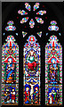
The church of SS Peter and Paul in Scarning - east window
The church of SS Peter and Paul > http://www.geograph.org.uk/photo/2050111 is situated in the heart of the village, beside Dereham Road, the main thoroughfare through Scarning. Its oldest part, the base of the tower, dates from the 12th century but the church as we see it today dates mainly from the 14th and 15th centuries. There was an extensive restoration in the 19th century. The treasure of the church is the fine 13th century baptismal font > http://www.geograph.org.uk/photo/2050126 which has a Jacobean cover that can be raised and lowered by a system of counter-weights. The rood screen > http://www.geograph.org.uk/photo/2050116 dates from the 15th century. The east window was installed in 1870.
Image: © Evelyn Simak
Taken: 1 Sep 2010
0.04 miles
5
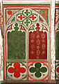
The church of SS Peter and Paul in Scarning - C15 rood screen (detail)
The church of SS Peter and Paul > http://www.geograph.org.uk/photo/2050111 is situated in the heart of the village, beside Dereham Road, the main thoroughfare through Scarning. Its oldest part, the base of the tower, dates from the 12th century but the church as we see it today dates mainly from the 14th and 15th centuries. There was an extensive restoration in the 19th century. The treasure of the church is the fine 13th century baptismal font > http://www.geograph.org.uk/photo/2050126 which has a Jacobean cover that can be raised and lowered by a system of counter-weights. The rood screen > http://www.geograph.org.uk/photo/2050116 dates from the 15th century. The east window > http://www.geograph.org.uk/photo/2050120 was installed in 1870.
Image: © Evelyn Simak
Taken: 1 Sep 2010
0.04 miles
6
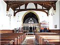
The church of SS Peter and Paul in Scarning - view east
The church of SS Peter and Paul > http://www.geograph.org.uk/photo/2050111 is situated in the heart of the village, beside Dereham Road, the main thoroughfare through Scarning. Its oldest part, the base of the tower, dates from the 12th century but the church as we see it today dates mainly from the 14th and 15th centuries. There was an extensive restoration in the 19th century. The treasure of the church is the fine 13th century baptismal font > http://www.geograph.org.uk/photo/2050126 which has a Jacobean cover that can be raised and lowered by a system of counter-weights. The rood screen > http://www.geograph.org.uk/photo/2050116 dates from the 15th century. The east window > http://www.geograph.org.uk/photo/2050120 was installed in 1870.
Image: © Evelyn Simak
Taken: 1 Sep 2010
0.04 miles
7
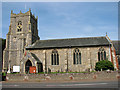
The church of SS Peter and Paul in Scarning
The church of SS Peter and Paul is situated in the heart of the village, beside Dereham Road, the main thoroughfare through Scarning. Its oldest part, the base of the tower, dates from the 12th century but the church as we see it today dates mainly from the 14th and 15th centuries. There was an extensive restoration in the 19th century. The treasure of the church is the fine 13th century baptismal font > http://www.geograph.org.uk/photo/2050126 which has a Jacobean cover that can be raised and lowered by a system of counter-weights. The rood screen > http://www.geograph.org.uk/photo/2050116 dates from the 15th century. The east window > http://www.geograph.org.uk/photo/2050120 was installed in 1870.
Image: © Evelyn Simak
Taken: 1 Sep 2010
0.04 miles
8
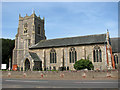
The church of SS Peter and Paul in Scarning
The church of SS Peter and Paul > http://www.geograph.org.uk/photo/2050111 is situated in the heart of the village, beside Dereham Road, the main thoroughfare through Scarning. Its oldest part, the base of the tower, dates from the 12th century but the church as we see it today dates mainly from the 14th and 15th centuries. There was an extensive restoration in the 19th century. The treasure of the church is the fine 13th century baptismal font > http://www.geograph.org.uk/photo/2050126 which has a Jacobean cover that can be raised and lowered by a system of counter-weights. The rood screen > http://www.geograph.org.uk/photo/2050116 dates from the 15th century. The east window > http://www.geograph.org.uk/photo/2050120 was installed in 1870.
Image: © Evelyn Simak
Taken: 1 Sep 2010
0.04 miles
9
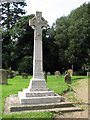
The war memorial in Scarning
It is situated beside the path through the churchyard of SS Peter and Paul > http://www.geograph.org.uk/photo/2050100.
Image: © Evelyn Simak
Taken: 1 Sep 2010
0.04 miles
10
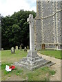
Scarning War Memorial
The memorial bears the names of twelve men killed in WW1 and of two killed in WW2
https://media.geograph.org.uk/files/fe9fc289c3ff0af142b6d3bead98a923/Scarning_War_Memorial1.pdf
Image: © Adrian S Pye
Taken: 13 Aug 2016
0.05 miles