
IMAGES TAKEN NEAR TO
Station Drive, DEREHAM, NR19 2JD
Introduction
This page details the photographs taken nearby to Station Drive, NR19 2JD by members of the Geograph project.
The Geograph project started in 2005 with the aim of publishing, organising and preserving representative images for every square kilometre of Great Britain, Ireland and the Isle of Man.

There are currently over 7.5m images from over14,400 individuals and you can help contribute to the project by visiting https://www.geograph.org.uk
Image Map
Images are licensed for reuse under creativecommons.org/licenses/by-sa/2.0
Notes
- Clicking on the map will re-center to the selected point.
- The higher the marker number, the further away the image location is from the centre of the postcode.
Image Listing (4 Images Found)
Images are licensed for reuse under creativecommons.org/licenses/by-sa/2.0
Image
Details
Distance
1
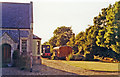
Former Fransham station, with rolling-stock 1991
View westward, towards Swaffham and King's Lynn: ex-GER Norwich - Wymondham - Dereham - Swaffham - King's Lynn line. The station closed, with line west from Dereham from 9/9/68. However, it is well preserved as a private house and the owner has kept an ex-GER coach and a small Diesel locomotive (of unknown provenance [?]) in his garden.
Image: © Ben Brooksbank
Taken: 8 Sep 1991
0.01 miles
2
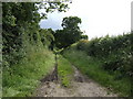
Moor Lane
This named right-of-way heads generally south to end at Spicers Corner near Image
Image: © Jonathan Billinger
Taken: 21 Jun 2007
0.14 miles
3
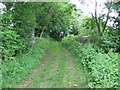
Old bridge
Old bridge that carries a farm track and footpath over a now dismantled railway near to Great Fransham Norfolk.
Image: © Keith Evans
Taken: 15 Jun 2008
0.17 miles
4
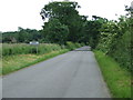
Great Fransham
Road leading to Great Fransham Norfolk.
Image: © Keith Evans
Taken: 15 Jun 2008
0.18 miles