IMAGES TAKEN NEAR TO
Morley St. Peter, WYMONDHAM, NR18 9TE
Introduction
This page details the photographs taken nearby to NR18 9TE by members of the Geograph project.
The Geograph project started in 2005 with the aim of publishing, organising and preserving representative images for every square kilometre of Great Britain, Ireland and the Isle of Man.

There are currently over 7.5m images from over14,400 individuals and you can help contribute to the project by visiting https://www.geograph.org.uk
Image Map
Images are licensed for reuse under creativecommons.org/licenses/by-sa/2.0
Notes
- Clicking on the map will re-center to the selected point.
- The higher the marker number, the further away the image location is from the centre of the postcode.
Image Listing (14 Images Found)
Images are licensed for reuse under creativecommons.org/licenses/by-sa/2.0
Image
Details
Distance
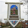
2
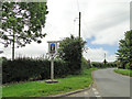
Morley St. Peter village sign
Detail of the sign can be seen here https://www.geograph.org.uk/photo/6194110
Image: © Adrian S Pye
Taken: 27 Jun 2019
0.15 miles
3
Morley St. Peter village sign (detail)
A wider view of the location can be seen here https://www.geograph.org.uk/photo/6194107
St Botolph https://www.geograph.org.uk/photo/6804584
Image: © Adrian S Pye
Taken: 27 Jun 2019
0.15 miles
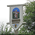
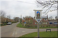
4
Morley St Botolph village sign (detail)
Two villages on one sign. On this side the parish of Morley St Botolph and on the other the parish of Morley St Peter. The saints are depicted in front of their relevant church. Below the sign are ears of wheat and a horseshoe reflecting the agricultural heritage of the parish. The arms are not recognised.
St Peter https://www.geograph.org.uk/photo/6194110
Image: © Adrian S Pye
Taken: 8 Apr 2021
0.15 miles
5
Morley St Botolph village sign
Two villages on one sign. On this side the parish of Morley St Botolph and on the other the parish of Morley St Peter. The saints are depicted in front of their relevant church. Below the sign are ears of wheat and a horseshoe reflecting the agricultural heritage of the parish.
Image: © Adrian S Pye
Taken: 8 Apr 2021
0.15 miles
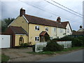
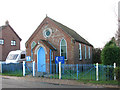
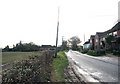
7
Chapel Road, Morley St. Botolph
Looking north.
Image: © JThomas
Taken: 13 May 2017
0.17 miles
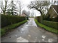
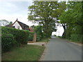
9
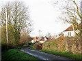
View west along Hall Lane
The lane turns off Chapel Road, leading past cottages before changing to a private road > http://www.geograph.org.uk/photo/1611411.
Image: © Evelyn Simak
Taken: 8 Dec 2009
0.20 miles