IMAGES TAKEN NEAR TO
Church Road, WYMONDHAM, NR18 9RS

Introduction

This page details the photographs taken nearby to Church Road, NR18 9RS by members of the Geograph project.

The Geograph project started in 2005 with the aim of publishing, organising and preserving representative images for every square kilometre of Great Britain, Ireland and the Isle of Man.

There are currently over 7.5m images from over14,400 individuals and you can help contribute to the project by visiting https://www.geograph.org.uk

Image Map


Images are licensed for reuse under creativecommons.org/licenses/by-sa/2.0
Notes
  • Clicking on the map will re-center to the selected point.
  • The higher the marker number, the further away the image location is from the centre of the postcode.

Image Listing (191 Images Found)

Images are licensed for reuse under creativecommons.org/licenses/by-sa/2.0
  • ...
Image
Details
Distance
1
Ruined building by the entrance to Ketteringham Hall
The hall was the headquarters of the USAAF's 2nd Air Division during WW2 and the adjacent camp housed about 700 personnel. I don't know whether this building was part of the camp.
Image: © Evelyn Simak Taken: 19 Feb 2015
0.00 miles
2
Entrance To Ketteringham Hall
Image: © Geoff Pick Taken: 31 Jul 2008
0.01 miles
3
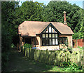
Thatched cottage in Ketteringham
Image: © Evelyn Simak Taken: 31 Aug 2016
0.01 miles
4
House opposite St Peter, Ketteringham, Norfolk
Image: © John Salmon Taken: 29 Mar 2005
0.02 miles
5
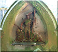
Head carpenter's gravestone
This is the grave of the head carpenter of Sir John and Sir Francis Boileau of Ketteringham Hall in St Peter's > http://www.geograph.org.uk/photo/1844017 churchyard.
Image: © Evelyn Simak Taken: 31 Aug 2016
0.02 miles
6
Cottage in Ketteringham
Image: © Evelyn Simak Taken: 31 Aug 2016
0.02 miles
7
Ketteringham War Memorial
The picture quality is poor because it was taken through the window of the locked building.
Image: © Adrian S Pye Taken: 10 Jun 2015
0.03 miles
8
Head carpenter's gravestone (detail)
For a full view see > http://www.geograph.org.uk/photo/5189163.
Image: © Evelyn Simak Taken: 31 Aug 2016
0.03 miles
9
Ketteringham Hall: aerial 2017 (1)
See: http://www.heritage.norfolk.gov.uk/record-details?MNF9501-Ketteringham-Hall&Index=8804&RecordCount=57339&SessionID=e5a4c265-a3b8-499c-a66b-289769a510b2
Image: © Chris Taken: 31 Aug 2017
0.03 miles
10
Ketteringham Hall: aerial 2017 (2)
See: http://www.heritage.norfolk.gov.uk/record-details?MNF9501-Ketteringham-Hall&Index=8804&RecordCount=57339&SessionID=e5a4c265-a3b8-499c-a66b-289769a510b2
Image: © Chris Taken: 31 Aug 2017
0.03 miles
  • ...