IMAGES TAKEN NEAR TO
The Oaks, WYMONDHAM, NR18 9QX
Introduction
This page details the photographs taken nearby to The Oaks, NR18 9QX by members of the Geograph project.
The Geograph project started in 2005 with the aim of publishing, organising and preserving representative images for every square kilometre of Great Britain, Ireland and the Isle of Man.

There are currently over 7.5m images from over14,400 individuals and you can help contribute to the project by visiting https://www.geograph.org.uk
Image Map
Images are licensed for reuse under creativecommons.org/licenses/by-sa/2.0
Notes
- Clicking on the map will re-center to the selected point.
- The higher the marker number, the further away the image location is from the centre of the postcode.
Image Listing (14 Images Found)
Images are licensed for reuse under creativecommons.org/licenses/by-sa/2.0
Image
Details
Distance
1
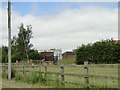
Water (Sewage) works on High Oak Road, Morley
Image: © Adrian S Pye
Taken: 27 Jun 2019
0.16 miles
2
Approaching High Oak crossroads, Morley
Image: © Adrian S Pye
Taken: 27 Jun 2019
0.16 miles
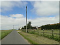
4
At The Hub
Six roads converge on the bungalow in the photograph, including Morleyfield and Milestone Lanes.
Image: © Roger Gilbertson
Taken: 2 Nov 2006
0.17 miles
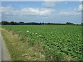
5
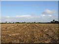
Cropped Short
A scene between Deopham and Highoak.
Image: © Roger Gilbertson
Taken: 2 Nov 2006
0.17 miles
6
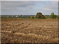
Towards Hackford
Part of which can be seen in the distance.
Image: © Roger Gilbertson
Taken: 2 Nov 2006
0.17 miles
7
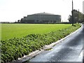
Hilltop Storage
An Anglian Water storage tank at the highest point on Highoak Lane; just over two hundred feet above sea level.
Image: © Roger Gilbertson
Taken: 2 Nov 2006
0.17 miles
9
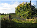
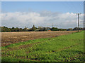
On Highoak Lane
A gate into a field.
Image: © Roger Gilbertson
Taken: 2 Nov 2006
0.17 miles
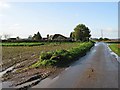
10

Top Road towards The Green
Looking north east.
Image: © JThomas
Taken: 17 Jun 2017
0.19 miles