IMAGES TAKEN NEAR TO
Wisteria Drive, WYMONDHAM, NR18 0FW
Introduction
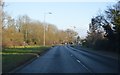
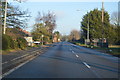
This page details the photographs taken nearby to Wisteria Drive, NR18 0FW by members of the Geograph project.
The Geograph project started in 2005 with the aim of publishing, organising and preserving representative images for every square kilometre of Great Britain, Ireland and the Isle of Man.

There are currently over 7.5m images from over14,400 individuals and you can help contribute to the project by visiting https://www.geograph.org.uk
Image Map
Images are licensed for reuse under creativecommons.org/licenses/by-sa/2.0
Notes
- Clicking on the map will re-center to the selected point.
- The higher the marker number, the further away the image location is from the centre of the postcode.
Image Listing (6 Images Found)
Images are licensed for reuse under creativecommons.org/licenses/by-sa/2.0
Image
Details
Distance
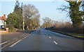
1
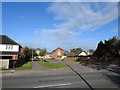
Snowdrop Street off Norwich Road, Wymondham
Image: © Adrian S Pye
Taken: 8 Nov 2018
0.18 miles
5
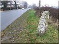
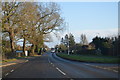
To Norwich 8
Old mile stone Wymondham, Norfolk. For close up view see http://www.geograph.org.uk/photo/1166755 For more info on the stone see http://milestones.megalithia.com/sites/tg125027.htm do take a look at their home page. This is one of a series of mileposts that follow the A11 see http://www.geograph.org.uk/search.php?i=5498676
Image: © Keith Evans
Taken: 17 Feb 2009
0.22 miles