IMAGES TAKEN NEAR TO
Ollands Road, ATTLEBOROUGH, NR17 2JD
Introduction
This page details the photographs taken nearby to Ollands Road, NR17 2JD by members of the Geograph project.
The Geograph project started in 2005 with the aim of publishing, organising and preserving representative images for every square kilometre of Great Britain, Ireland and the Isle of Man.

There are currently over 7.5m images from over14,400 individuals and you can help contribute to the project by visiting https://www.geograph.org.uk
Image Map
Images are licensed for reuse under creativecommons.org/licenses/by-sa/2.0
Notes
- Clicking on the map will re-center to the selected point.
- The higher the marker number, the further away the image location is from the centre of the postcode.
Image Listing (8 Images Found)
Images are licensed for reuse under creativecommons.org/licenses/by-sa/2.0
Image
Details
Distance
1
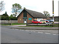
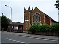
Hargham Road chapel with cars
Compare with > http://www.geograph.org.uk/photo/1799763. The chapel is situated by the junction of Hargham Road and Poplar Way.
Image: © Evelyn Simak
Taken: 11 May 2010
0.10 miles
2
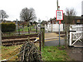
The end of Leys Lane, Attleborough
The lane ends by this pedestrian level crossing on the East Midlands and Breckland Line with trains running from Norwich to Ely, Cambridge and Peterborough.
Image: © Evelyn Simak
Taken: 2 Jan 2011
0.11 miles
3
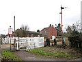
Level crossing at the end of Leys Lane
Pedestrian level crossing on the East Midlands and Breckland Line, with trains running from Norwich to Ely, Cambridge and Peterborough.
Image: © Evelyn Simak
Taken: 2 Jan 2011
0.11 miles
4
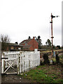
Old semaphore signal, Attleborough
The signal is situated by the pedestrian level crossing at the end of Leys Lane, a short distance to the south-west of Attleborough station. The station is served by the East Midlands and Breckland lines with trains running from Norwich to Ely, Cambridge and Peterborough.
Image: © Evelyn Simak
Taken: 2 Jan 2011
0.14 miles
5
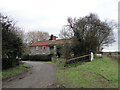
Flint Cottage near at the end of Ley's Lane
Just before the railway line ends the road.
Image: © Adrian S Pye
Taken: 2 Jan 2011
0.17 miles
6
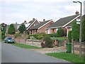
Bus stop in Hargham Road, Attleborough
Image: © Andrew Longton
Taken: 15 Aug 2006
0.18 miles
7
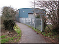
Public footpath past business units, Attleborough
The path starts at the pedestrian level crossing at the end of Leys Lane, leading to the B1077 road a short distance further to the north-east.
Image: © Evelyn Simak
Taken: 2 Jan 2011
0.19 miles