
IMAGES TAKEN NEAR TO
Attleborough Road/Coronation Terrace, Attleborough Road, ATTLEBOROUGH, NR17 1DL
Introduction
This page details the photographs taken nearby to Attleborough Road/Coronation Terrace, Attleborough Road, NR17 1DL by members of the Geograph project.
The Geograph project started in 2005 with the aim of publishing, organising and preserving representative images for every square kilometre of Great Britain, Ireland and the Isle of Man.

There are currently over 7.5m images from over14,400 individuals and you can help contribute to the project by visiting https://www.geograph.org.uk
Image Map
Images are licensed for reuse under creativecommons.org/licenses/by-sa/2.0
Notes
- Clicking on the map will re-center to the selected point.
- The higher the marker number, the further away the image location is from the centre of the postcode.
Image Listing (73 Images Found)
Images are licensed for reuse under creativecommons.org/licenses/by-sa/2.0
Image
Details
Distance
1
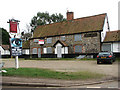
The Red Lion Pub
Caston is located near the British Army's battle training area and surrounded by farmland on all sides. It is believed that the village dates back as far as to the 8th or 9th century. Caston has a large village green that is surrounded by picturesque cottages; in 1988 the village won the Best Kept Village Competition for villages under a population size of 500.
The village pub, The Red Lion, is located on the green and presently for sale.
Image: © Evelyn Simak
Taken: 23 Feb 2008
0.03 miles
2
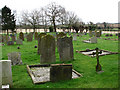
Church of the Holy Cross - churchyard
The earliest mention of a church can be found in a document dated from 1218 but an older church may well have stood on the site before this time. The entrance to the present Church of the Holy Cross is through the west tower with an unusual pointed ogee-arched shape. A candelabra, supposedly originating from Hapton Court and given by Charles I to a church in Hertfordshire hangs in the chancel, and one of the south windows contains English and Continental medieval glass. There are misericord seats with carved faces in the return stalls in the chancel and a number of carved medieval bench ends in the west end of the nave. The church is open every day. For more information see: http://www.norfolkchurches.co.uk/caston/caston.htm
Image: © Evelyn Simak
Taken: 23 Feb 2008
0.06 miles
3
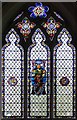
Holy Cross Church, Caston, Norfolk - East window
Image: © John Salmon
Taken: 10 May 2008
0.06 miles
4
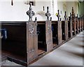
Holy Cross Church, Caston, Norfolk - Pews
Image: © John Salmon
Taken: 10 May 2008
0.06 miles
5
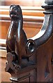
Holy Cross Church, Caston, Norfolk - Bench elbow
Image: © John Salmon
Taken: 10 May 2008
0.06 miles
6
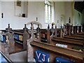
Holy Cross Church, Caston, Norfolk - Pews
Image: © John Salmon
Taken: 10 May 2008
0.06 miles
7
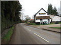
The Street past the Red Lion Pub
Caston is located near the British Army's battle training area and surrounded by farmland on all sides. It is believed that the village dates back as far as to the 8th or 9th century. Caston has a large village green that is surrounded by picturesque cottages; in 1988 the village won the Best Kept Village Competition for villages under a population size of 500. The village pub, The Red Lion, is located on the green and presently for sale. See also > Image
Image: © Evelyn Simak
Taken: 23 Feb 2008
0.06 miles

9

Holy Cross Church, Caston, Norfolk - Bench end
Image: © John Salmon
Taken: 10 May 2008
0.06 miles
10

Holy Cross Church, Caston, Norfolk - Bench elbow
Image: © John Salmon
Taken: 10 May 2008
0.07 miles