
IMAGES TAKEN NEAR TO
Cider Court, NORWICH, NR16 2ST
Introduction
This page details the photographs taken nearby to Cider Court, NR16 2ST by members of the Geograph project.
The Geograph project started in 2005 with the aim of publishing, organising and preserving representative images for every square kilometre of Great Britain, Ireland and the Isle of Man.

There are currently over 7.5m images from over14,400 individuals and you can help contribute to the project by visiting https://www.geograph.org.uk
Image Map
Images are licensed for reuse under creativecommons.org/licenses/by-sa/2.0
Notes
- Clicking on the map will re-center to the selected point.
- The higher the marker number, the further away the image location is from the centre of the postcode.
Image Listing (124 Images Found)
Images are licensed for reuse under creativecommons.org/licenses/by-sa/2.0
Image
Details
Distance
1
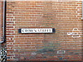
Crown Street sign
On Crown Street at the junction with Church Hill & Scrumpy Way
Image: © Geographer
Taken: 19 Jul 2016
0.00 miles
2
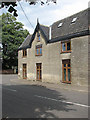
House by junction of Crown Street and Church Hill
Perhaps most widely known for its renowned zoo, the village of Banham is located along the B1113, 11 kilometres north of Diss, 19 kilometres east of Thetford and 32 kilometres south-west of Norwich. The tree-lined village green > http://www.geograph.org.uk/photo/1408840 is surrounded by old thatched houses > http://www.geograph.org.uk/photo/1408825 some with overhanging storeys, and dominated by St Mary's church > http://www.geograph.org.uk/photo/1408886 which adjoins the green in the west. Industries in Banham include the Gaymer Cider factory and brick making from locally found clay. The village has a number of small shops, a Spar supermarket and a village shop > http://www.geograph.org.uk/photo/1408855 and post office, two pubs, and a primary school which caters for about 120 pupils.
Image: © Evelyn Simak
Taken: 20 Jul 2009
0.01 miles
3
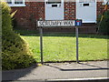
Scrumpy way sign
On Scrumpy way at the junction with Church Hill
Image: © Geographer
Taken: 6 Aug 2016
0.01 miles
4

Telephone Box on Church Hill
At the junction with Scrumpy Way
Image: © Geographer
Taken: 19 Jul 2016
0.01 miles
5
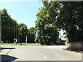
Crown Street, Banham
At the junction with Church Hill
Image: © Geographer
Taken: 19 Jul 2016
0.02 miles
6
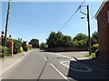
Church Hill, Banham
At the junction with Scrumpy Way
Image: © Geographer
Taken: 19 Jul 2016
0.02 miles
7
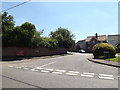
Scrumpy Way, Banham
At the junction with Church Hill
Image: © Geographer
Taken: 19 Jul 2016
0.02 miles
8
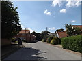
Church Hill, Banham
At the junction with Scrumpy Way
Image: © Geographer
Taken: 6 Aug 2016
0.02 miles
9
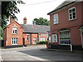
Approaching Crown Street
Perhaps most widely known for its renowned zoo, the village of Banham is located along the B1113, 11 kilometres north of Diss, 19 kilometres east of Thetford and 32 kilometres south-west of Norwich. The tree-lined village green > http://www.geograph.org.uk/photo/1408840 is surrounded by old thatched houses > http://www.geograph.org.uk/photo/1408825 some with overhanging storeys, and dominated by St Mary's church > http://www.geograph.org.uk/photo/1408886 which adjoins the green in the west. Industries in Banham include the Gaymer Cider factory and brick making from locally found clay. The village has a number of small shops, a Spar supermarket and a village shop > http://www.geograph.org.uk/photo/1408855 and post office, two pubs, and a primary school which caters for about 120 pupils.
Image: © Evelyn Simak
Taken: 20 Jul 2009
0.02 miles
10

Banham - the village sign
The village sign > http://www.geograph.org.uk/photo/1408844 is located on the green by Church Hill. Perhaps most widely known for its renowned zoo, the village of Banham is located along the B1113, 11 kilometres north of Diss, 19 kilometres east of Thetford and 32 kilometres south-west of Norwich. The tree-lined village green > http://www.geograph.org.uk/photo/1408840 is surrounded by old thatched houses > http://www.geograph.org.uk/photo/1408825 some with overhanging storeys, and dominated by St Mary's church > http://www.geograph.org.uk/photo/1408886 which adjoins the green in the west. Industries in Banham include the Gaymer Cider factory and brick making from locally found clay. The village has a number of small shops, a Spar supermarket and a village shop > http://www.geograph.org.uk/photo/1408855 and post office, two pubs, and a primary school which caters for about 120 pupils.
Image: © Evelyn Simak
Taken: 20 Jul 2009
0.02 miles