
IMAGES TAKEN NEAR TO
The Pyghtle, NORWICH, NR16 2NL
Introduction
This page details the photographs taken nearby to The Pyghtle, NR16 2NL by members of the Geograph project.
The Geograph project started in 2005 with the aim of publishing, organising and preserving representative images for every square kilometre of Great Britain, Ireland and the Isle of Man.

There are currently over 7.5m images from over14,400 individuals and you can help contribute to the project by visiting https://www.geograph.org.uk
Image Map
Images are licensed for reuse under creativecommons.org/licenses/by-sa/2.0
Notes
- Clicking on the map will re-center to the selected point.
- The higher the marker number, the further away the image location is from the centre of the postcode.
Image Listing (41 Images Found)
Images are licensed for reuse under creativecommons.org/licenses/by-sa/2.0
Image
Details
Distance
1
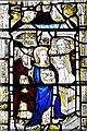
East Harling, St. Peter and St. Pauls' Church: The magnificent Norwich medieval glass east window 8 (detail)
The old priest Simeon received Jesus in the Temple.
Image: © Michael Garlick
Taken: 25 May 2018
0.05 miles
2
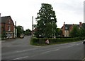
East Harling
Almost the same scene as The previous submission but taken 20 years, almost to the week, later. I'd often looked at the earlier picture and could never quite make out the name of the village. Then quite by chance I visited the same place whilst on holiday in the area.
Image: © Ian M
Taken: 30 Jul 2005
0.05 miles
3
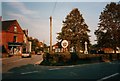
East Harling
Village sign at East Harling, approaching from the NW, in late July, 1985.
Image: © Ian M
Taken: Unknown
0.05 miles
4
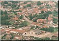
Market Street, East Harling (B1111)
This view shows the main village centre. The site in the foreground with the sheds is now a small housing development built in 2002.
Image: © Don Grunbaum
Taken: Unknown
0.06 miles
5
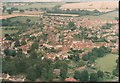
The main village of East Harling
Taken from the air above the recreation ground
Image: © Don Grunbaum
Taken: Unknown
0.08 miles
6
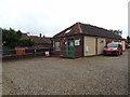
East Harling Post Office
Off the B1111 Market Square
Image: © Geographer
Taken: 18 Jun 2016
0.08 miles
8
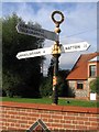
Direction Sign ? Signpost
Located on the northeast side of the junction of Market Street, King Street and the B1111 Garboldisham Road in Harling parish. 3 arms and annulus finial. Moved from across Market Street some time between 2004 and 2011.
Milestone Society National ID: NO_TL9986
Image: © J Young
Taken: 15 Aug 2004
0.09 miles
9
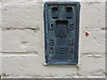
Ordnance Survey Flush Bracket G1554
This bracket can be found on the roadside wall of a private dwelling (formerly Bull Inn) at East Harling. The benchmark is recorded as being 23.085 metres above sea level.
For more detail see : https://www.bench-marks.org.uk/bm10685
Image: © Peter Wood
Taken: 21 Feb 2020
0.09 miles
10
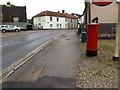
B1111 Market Square & Market Square Postbox
Postbox No.NR16 1635
Image: © Geographer
Taken: 18 Jun 2016
0.09 miles