IMAGES TAKEN NEAR TO
Bustards Green, NORWICH, NR16 1JE
Introduction
This page details the photographs taken nearby to Bustards Green, NR16 1JE by members of the Geograph project.
The Geograph project started in 2005 with the aim of publishing, organising and preserving representative images for every square kilometre of Great Britain, Ireland and the Isle of Man.

There are currently over 7.5m images from over14,400 individuals and you can help contribute to the project by visiting https://www.geograph.org.uk
Image Map
Images are licensed for reuse under creativecommons.org/licenses/by-sa/2.0
Notes
- Clicking on the map will re-center to the selected point.
- The higher the marker number, the further away the image location is from the centre of the postcode.
Image Listing (16 Images Found)
Images are licensed for reuse under creativecommons.org/licenses/by-sa/2.0
Image
Details
Distance
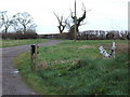
1
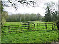
Gate into pasture by Chestnut Tree Farm
Image: © Evelyn Simak
Taken: 2 Apr 2014
0.09 miles

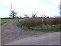
3
Bustard's Green near Bustard's Green Farm
Image: © Adrian S Pye
Taken: 19 Dec 2018
0.12 miles
4
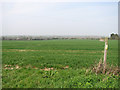
Footpath to Forncett St Peter
The haze is not caused by fog but by a combination of high air pollution and dust originating from a storm in the Saharan desert. Whilst large parts of England are experiencing unusually high levels of pollution today, the eastern region is one of the worst affected and people were advised to stay indoors.
Image: © Evelyn Simak
Taken: 2 Apr 2014
0.16 miles
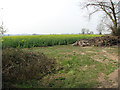
5
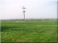
Electricity pole in wheat crop by Old Court Farm
The haze is not caused by fog but by a combination of high air pollution and dust originating from a storm in the Saharan desert. Whilst large parts of England are experiencing unusually high levels of pollution today, the eastern region is one of the worst affected and people were advised to stay indoors.
Image: © Evelyn Simak
Taken: 2 Apr 2014
0.17 miles
6
Hill Farm Sign Looking Worse for Wear
Image: © Ian Robertson
Taken: 28 Feb 2007
0.18 miles
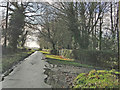
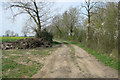
8
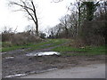
Track leading to Randall's Farm
Bustard's Green
Image: © Ian Robertson
Taken: 28 Feb 2007
0.19 miles
9
Oilseed rape crop by Bustard's Green Farm
Image: © Evelyn Simak
Taken: 2 Apr 2014
0.19 miles
10
Footpath and farm track to Randall's Farm
Image: © Evelyn Simak
Taken: 2 Apr 2014
0.20 miles