
IMAGES TAKEN NEAR TO
New Road, NORWICH, NR16 1DW
Introduction
This page details the photographs taken nearby to New Road, NR16 1DW by members of the Geograph project.
The Geograph project started in 2005 with the aim of publishing, organising and preserving representative images for every square kilometre of Great Britain, Ireland and the Isle of Man.

There are currently over 7.5m images from over14,400 individuals and you can help contribute to the project by visiting https://www.geograph.org.uk
Image Map
Images are licensed for reuse under creativecommons.org/licenses/by-sa/2.0
Notes
- Clicking on the map will re-center to the selected point.
- The higher the marker number, the further away the image location is from the centre of the postcode.
Image Listing (19 Images Found)
Images are licensed for reuse under creativecommons.org/licenses/by-sa/2.0
Image
Details
Distance
1

Access road to the Tacolneston transmitting station
For a view of the masts see > http://www.geograph.org.uk/photo/4288081.
Image: © Evelyn Simak
Taken: 23 Dec 2014
0.05 miles

3

Perimeter fence around Tacolneston Transmitting Station
The current mast > http://www.geograph.org.uk/photo/1412446 is 221 metres high and presently owned and operated by National Grid Wireless. Before privatising their transmission department in 1997 it was owned by the BBC. National Grid Wireless plan to replace the current with a higher mast in order to ensure good digital TV reception across East Anglia after digital switchover, which is planned to take place in the area in Jun 2011. See also http://www.ukfree.tv/txdetail.php?a=TM131958.
Image: © Evelyn Simak
Taken: 24 Jul 2009
0.14 miles


6

View towards the Tacolneston Transmitting Station
The current mast is 221 metres high and presently owned and operated by National Grid Wireless. Before privatising their transmission department in 1997 it was owned by the BBC. National Grid Wireless plan to replace the current with a higher mast in order to ensure good digital TV reception across East Anglia after digital switchover, which is planned to take place in the area in Jun 2011. See also http://www.ukfree.tv/txdetail.php?a=TM131958.
Update: Power to the 505ft mast and its four analogue transmitters, which have provided analogue pictures to homes across the region since 1956, was switched off at midnight on 22 Nov 2011, as Norfolk and Suffolk TVs went digital.
Image: © Evelyn Simak
Taken: 24 Jul 2009
0.17 miles
7

Gated entrance to transmitter station
The current mast > http://www.geograph.org.uk/photo/1412446 at the Tacolneston transmitting station is 221 metres high and presently owned and operated by National Grid Wireless. Before privatising their transmission department in 1997 it was owned by the BBC. National Grid Wireless plan to replace the current with a higher mast in order to ensure good digital TV reception across East Anglia after digital switchover, which is planned to take place in the area in Jun 2011. See also http://www.ukfree.tv/txdetail.php?a=TM131958.
Image: © Evelyn Simak
Taken: 24 Jul 2009
0.18 miles

9

Track past the Tacolneston Transmitter
Image: © Evelyn Simak
Taken: 24 Jul 2009
0.19 miles
10
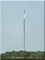
Tacolneston Television Transmission Mast
Taken from Bunwell Street
(Close up)
Image: © Geographer
Taken: 30 Aug 2016
0.20 miles