1
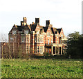
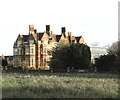
Whitlingham Hall - from Hall to Hospital to private housing
Originally named Crown Point Hall it was first erected in 1784 and rebuilt about 1865. The Hall was home to the Colman family who sold it in 1955 when the complex was converted into Whitlingham Hospital. The hospital has since closed and the Hall is presently used as private housing. See also > http://www.geograph.org.uk/photo/170201. Not to be confused with Whitlingham Hall which is located just a couple of kilometres further to the east > http://www.geograph.org.uk/photo/1388679.
Image: © Evelyn Simak
Taken: 5 Jul 2009
0.05 miles
2
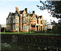
Whitlingham Hall, Trowse
Originally this was Crown Point Hall, first erected in 1784 and rebuilt about 1865 and seat of the Colman family but sold in 1955 to become Whitlingham Hospital. The hospital has since closed and the hall converted into private housing.
Image: © Graham Hardy
Taken: 14 May 2006
0.06 miles
3
Entrance to Whitlingham Hall
Originally named Crown Point Hall it was first erected in 1784 and rebuilt about 1865. The Hall was home to the Colman family who sold it in 1955 when the complex was converted into Whitlingham Hospital. The hospital has since closed and the Hall is presently used as private housing. Not to be confused with Whitlingham Hall which is located just a couple of kilometres further to the east > http://www.geograph.org.uk/photo/1388679.
Image: © Evelyn Simak
Taken: 5 Jul 2009
0.08 miles
4
Crown Point Hall
Once the home of the Colman family, the hall has since been a hospital and currently comprises private apartments, currently known as Whitlingham Hall.
Image: © Evelyn Simak
Taken: 20 Dec 2015
0.08 miles
5
Crown Point Hall
Once the home of the Colman family, the hall has since been a hospital and currently comprises private apartments, currently known as Whitlingham Hall.
Image: © Evelyn Simak
Taken: 20 Dec 2015
0.08 miles
6
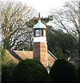
Whitlingham Hall - the clock tower
The hall once used to be the home of the Colman family.
Image: © Evelyn Simak
Taken: 20 Dec 2015
0.08 miles
7
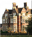
Whitlingham Hall
Now converted into private apartments.
Image: © Evelyn Simak
Taken: 20 Dec 2015
0.08 miles
8
Whitlingham Hall
The hall has since been converted into private apartments.
Image: © Evelyn Simak
Taken: 20 Dec 2015
0.08 miles
9
Cycleway to Kirby Road
The road seen in the foreground provides access to Whitlingham Quarry & Readymix Plant. Past the gate seen in mid-distance it is also the access road to Whitlingham Hall which has been converted into private housing. The entrance to the Hall can be seen just past the gate (at left). Used as a cycleway it links Kirby Road in Kirby Bedon with Whitlingham Lane in Trowse Newton.
Image: © Evelyn Simak
Taken: 5 Jul 2009
0.09 miles
10
Access road to Whitlingham Quarry & Readymix Plant
This private road turns off Kirby Road, leading to Whitlingham Hall and to Whitlingham Quarry beyond. It is also a cycleway.
Image: © Evelyn Simak
Taken: 5 Jul 2009
0.10 miles


