
IMAGES TAKEN NEAR TO
Beck Way, NORWICH, NR14 6UZ
Introduction
This page details the photographs taken nearby to Beck Way, NR14 6UZ by members of the Geograph project.
The Geograph project started in 2005 with the aim of publishing, organising and preserving representative images for every square kilometre of Great Britain, Ireland and the Isle of Man.

There are currently over 7.5m images from over14,400 individuals and you can help contribute to the project by visiting https://www.geograph.org.uk
Image Map
Images are licensed for reuse under creativecommons.org/licenses/by-sa/2.0
Notes
- Clicking on the map will re-center to the selected point.
- The higher the marker number, the further away the image location is from the centre of the postcode.
Image Listing (274 Images Found)
Images are licensed for reuse under creativecommons.org/licenses/by-sa/2.0
Image
Details
Distance
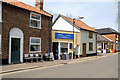
2
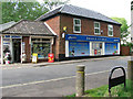
Bridge Stores
Loddon is a market town in the Broadland district in South Norfolk, located on the River Chet, where there is a marina and staithes once used by the wherries. The watermill > http://www.geograph.org.uk/photo/1418845 by the bridge across the river is recorded to be the oldest building in the town. The town centre has been designated as a conservation area and is made up of many period properties > http://www.geograph.org.uk/photo/1418870. Most of the village shops > http://www.geograph.org.uk/photo/1418876 are situated along Bridge Street > http://www.geograph.org.uk/photo/1418866 - the main thoroughfare, as is Holy Trinity church > http://www.geograph.org.uk/photo/525219.
Image: © Evelyn Simak
Taken: 28 Jul 2009
0.09 miles
3
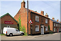
Bridge Street, Loddon
Houses and 'ducks' sign
Image: © Pierre Terre
Taken: 3 May 2008
0.09 miles
4
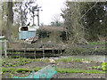
WW2 hexagonal pillbox at Loddon, seen from Chedgrave
Image: © Adrian S Pye
Taken: 7 Apr 2015
0.09 miles
5
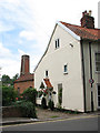
The Mill House
It adjoins Loddon Mill > http://www.geograph.org.uk/photo/1418854. Loddon is a market town in the Broadland district in South Norfolk, located on the River Chet, where there is a marina and staithes once used by the wherries. The watermill > http://www.geograph.org.uk/photo/1418845 by the bridge across the river is recorded to be the oldest building in the town. The town centre has been designated as a conservation area and is made up of many period properties > http://www.geograph.org.uk/photo/1418870. Most of the village shops > http://www.geograph.org.uk/photo/1418876 are situated along Bridge Street > http://www.geograph.org.uk/photo/1418866 - the main thoroughfare, as is Holy Trinity church > http://www.geograph.org.uk/photo/525219.
Image: © Evelyn Simak
Taken: 28 Jul 2009
0.09 miles
6
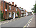
Cottages in Bridge Street
Loddon is a market town in the Broadland district in South Norfolk, located on the River Chet, where there is a marina and staithes once used by the wherries. The watermill > http://www.geograph.org.uk/photo/1418845 by the bridge across the river is recorded to be the oldest building in the town. The town centre has been designated as a conservation area and is made up of many period properties > http://www.geograph.org.uk/photo/1418870. Most of the village shops > http://www.geograph.org.uk/photo/1418876 are situated along Bridge Street > http://www.geograph.org.uk/photo/1418866 - the main thoroughfare, as is Holy Trinity church > http://www.geograph.org.uk/photo/525219.
Image: © Evelyn Simak
Taken: 28 Jul 2009
0.09 miles
7
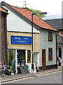
Rosy Lees Tearoom
Loddon is a market town in the Broadland district in South Norfolk, located on the River Chet, where there is a marina and staithes once used by the wherries. The watermill > http://www.geograph.org.uk/photo/1418845 by the bridge across the river is recorded to be the oldest building in the town. The town centre has been designated as a conservation area and is made up of many period properties > http://www.geograph.org.uk/photo/1418870. Most of the village shops > http://www.geograph.org.uk/photo/1418876 are situated along Bridge Street > http://www.geograph.org.uk/photo/1418866 - the main thoroughfare, as is Holy Trinity church > http://www.geograph.org.uk/photo/525219.
Image: © Evelyn Simak
Taken: 28 Jul 2009
0.09 miles
8
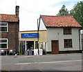
One up one down beside Rosy Lees Tearoom
Loddon is a market town in the Broadland district in South Norfolk, located on the River Chet, where there is a marina and staithes once used by the wherries. The watermill > http://www.geograph.org.uk/photo/1418845 by the bridge across the river is recorded to be the oldest building in the town. The town centre has been designated as a conservation area and is made up of many period properties > http://www.geograph.org.uk/photo/1418870. Most of the village shops > http://www.geograph.org.uk/photo/1418876 are situated along Bridge Street > http://www.geograph.org.uk/photo/1418866 - the main thoroughfare, as is Holy Trinity church > http://www.geograph.org.uk/photo/525219.
Image: © Evelyn Simak
Taken: 28 Jul 2009
0.09 miles
9
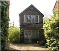
Old one-up one-down
In a backyard off Bridge Street. Loddon is a market town in the Broadland district in South Norfolk, located on the River Chet, where there is a marina and staithes once used by the wherries. The watermill > http://www.geograph.org.uk/photo/1418845 by the bridge across the river is recorded to be the oldest building in the town. The town centre has been designated as a conservation area and is made up of many period properties > http://www.geograph.org.uk/photo/1418870. Most of the village shops > http://www.geograph.org.uk/photo/1418876 are situated along Bridge Street > http://www.geograph.org.uk/photo/1418866 - the main thoroughfare, as is Holy Trinity church > http://www.geograph.org.uk/photo/525219.
Image: © Evelyn Simak
Taken: 26 Apr 2018
0.09 miles
10
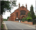
St John's church in George Lane
St John's Church - see also > http://www.geograph.org.uk/photo/5753168 - was built by Wesleyan Methodists in 1893. Part of this church was a VAD hospital during WW1. The 20-bed hospital was opened on 19 November 1914 and housed in the church's lecture hall. It was staffed by local women, assisted by men for heavier duties. Concerts by the church choir provided some of the entertainments. On 2 October 1918, the premises were destroyed by fire, presumed to have been caused by a combustion stove. Several days after the fire the Revd J Mattinson offered the vicarage, which by the end of October was ready for use. It remained in use until the final closure on 23 November 1918, following the sudden death of Dr McClintock, the medical officer. 474 patients are documented to have been treated at the hospital. The lecture hall was rebuilt in 1923.
Image: © Evelyn Simak
Taken: 28 Jul 2009
0.10 miles