
IMAGES TAKEN NEAR TO
The Boltons, NORWICH, NR14 6SS
Introduction
This page details the photographs taken nearby to The Boltons, NR14 6SS by members of the Geograph project.
The Geograph project started in 2005 with the aim of publishing, organising and preserving representative images for every square kilometre of Great Britain, Ireland and the Isle of Man.

There are currently over 7.5m images from over14,400 individuals and you can help contribute to the project by visiting https://www.geograph.org.uk
Image Map
Images are licensed for reuse under creativecommons.org/licenses/by-sa/2.0
Notes
- Clicking on the map will re-center to the selected point.
- The higher the marker number, the further away the image location is from the centre of the postcode.
Image Listing (58 Images Found)
Images are licensed for reuse under creativecommons.org/licenses/by-sa/2.0
Image
Details
Distance


3

Hales and Heckingham village sign
This side of the sign shows Heckingham St Gregory’s church and the joint War Memorial with Hales. Can you spot the mouse. The other side shows Hales St Margaret’s church and the War Memorial https://www.geograph.org.uk/photo/2221064
Image: © Adrian S Pye
Taken: 19 Nov 2020
0.03 miles
4
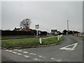
Hales with Heckingham Village sign
For a closer look at the sign see > https://www.geograph.org.uk/photo/6731810
Image: © Adrian S Pye
Taken: 5 Jan 2011
0.03 miles
5

The Hales and Heckingham village sign (close-up)
For a wider view of its location see > http://www.geograph.org.uk/photo/1505307.
Image: © Evelyn Simak
Taken: 24 Sep 2009
0.04 miles
6

Old Direction Sign - Signpost by the B1136, Yarmouth Road, Hales
Bishop finial - 4 arms; by the B1136, in parish of Hales (South Norfolk District), junction of Yarmouth Road with Green Lane, on grass verge.
Surveyed
Milestone Society National ID: NO_TM3797
Image: © Milestone Society
Taken: Unknown
0.04 miles
7
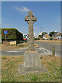
Hales War Memorial
The memorial stands in the centre of a grass triangle at a crossroads in the village of Hales. The memorial serves two parishes, Hales and Heckingham which is on the western face.
This face which is for Hales bears the names of thirteen men who fell in the Great War. Just below those names are three more names, they are the men who were killed in the Second World War.
https://www.geograph.org.uk/photo/6582582
Image: © Adrian S Pye
Taken: 16 Jul 2018
0.04 miles
8

Hales and Heckingham War Memorial
The memorial stands in the centre of a grass triangle at a crossroads in the village of Hales. The face visible on this image is for the parish of Heckingham which bears the names of four who "laid down their lives for their country in the Great War 1914-1918."
https://www.geograph.org.uk/photo/6582601
Image: © Adrian S Pye
Taken: 24 Sep 2018
0.04 miles
9
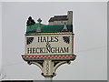
Hales & Heckingham Village sign
This side of the sign shows Hales St Margaret’s church and the joint War Memorial with Heckingham. The other side shows Heckingham St Gregory’s church and the War Memorial. For a complete scene see > https://www.geograph.org.uk/photo/2221061
Image: © Adrian S Pye
Taken: 5 Jan 2011
0.04 miles
10
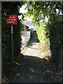
Path from Preston Lane to Yarmouth Road (B1136)
Image: © Evelyn Simak
Taken: 24 Sep 2009
0.04 miles