IMAGES TAKEN NEAR TO
Kittens Lane, NORWICH, NR14 6JU

Introduction

This page details the photographs taken nearby to Kittens Lane, NR14 6JU by members of the Geograph project.

The Geograph project started in 2005 with the aim of publishing, organising and preserving representative images for every square kilometre of Great Britain, Ireland and the Isle of Man.

There are currently over 7.5m images from over14,400 individuals and you can help contribute to the project by visiting https://www.geograph.org.uk

Image Map


Images are licensed for reuse under creativecommons.org/licenses/by-sa/2.0
Notes
  • Clicking on the map will re-center to the selected point.
  • The higher the marker number, the further away the image location is from the centre of the postcode.

Image Listing (245 Images Found)

Images are licensed for reuse under creativecommons.org/licenses/by-sa/2.0
  • ...
Image
Details
Distance
1
Hobart High school
Main entrance to Hobart High school Loddon Norfolk.
Image: © Keith Evans Taken: 9 Aug 2008
0.02 miles
2
Loddon town sign plaque
Plaque attached to the sign Loddon Norfolk see http://www.geograph.org.uk/photo/919340 for full view of the Saxon.
Image: © Keith Evans Taken: 9 Aug 2008
0.10 miles
3
Direction sign
Distance direction sign Loddon Norfolk
Image: © Keith Evans Taken: 9 Aug 2008
0.10 miles
4
Loddon village sign
The plaque reads thus "Alfric called Modercope was the original Saxon Lord of Loddon and gave the Lordship to the Abbey of St. Edmund of Bury in the reign of Edward the Confessor 1042 - 1066. The poor box of Saxon Origin (on which he rests his hand) is a replica of that standing in the church and thought to be a relic of the chapel of St. Mary." https://www.geograph.org.uk/photo/6679872
Image: © Adrian S Pye Taken: 7 Oct 2008
0.10 miles
5
Loddon village sign
The plaque reads thus "Alfric called Modercope was the original Saxon Lord of Loddon and gave the Lordship to the Abbey of St. Edmund of Bury in the reign of Edward the Confessor 1042 - 1066. The poor box of Saxon Origin (on which he rests his hand) is a replica of that standing in the church and thought to be a relic of the chapel of St. Mary."
Image: © Adrian S Pye Taken: 7 Oct 2008
0.10 miles
6
Loddon village sign
The plaque reads thus "Alfric called Modercope was the original Saxon Lord of Loddon and gave the Lordship to the Abbey of St. Edmund of Bury in the reign of Edward the Confessor 1042 - 1066. The poor box of Saxon Origin (on which he rests his hand) is a replica of that standing in the church and thought to be a relic of the chapel of St. Mary." https://www.geograph.org.uk/photo/6679872 Wider view - https://www.geograph.org.uk/photo/4296020
Image: © Adrian S Pye Taken: 19 Nov 2020
0.10 miles
7
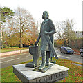
Loddon High Street with Town Sign
The High Street ahead leads to Church Plain on your Right.The statue is one of the Saxon founder of Loddon, here is a link to the same place in 1905. http://www.commanet.org/reflect.aspx?action=navselect&rec=5009999900081424&dir=N&language=English&freetext=loddon&view=large
Image: © Ray Garrod Taken: 29 Feb 2004
0.11 miles
8
The High Street, Loddon
A small statue of Alfric, the original Saxon lord of Loddon, looks down the High Street
Image: © Tim Heaton Taken: 15 Sep 2008
0.11 miles
9
Loddon Post Office
Loddon is a market town in the Broadland district in South Norfolk, located on the River Chet, where there is a marina and staithes once used by the wherries. The watermill > http://www.geograph.org.uk/photo/1418845 by the bridge across the river is recorded to be the oldest building in the town. The town centre has been designated as a conservation area and is made up of many period properties > http://www.geograph.org.uk/photo/1418870. Most of the village shops > http://www.geograph.org.uk/photo/1418876 are situated along Bridge Street > http://www.geograph.org.uk/photo/1418866 - the main thoroughfare, as is Holy Trinity church > http://www.geograph.org.uk/photo/525219.
Image: © Evelyn Simak Taken: 28 Jul 2009
0.11 miles
10
Saxon Lord of Loddon
Loddon town sign of the Saxon Lord of Loddon Norfolk for more info see http://www.geograph.org.uk/photo/919343
Image: © Keith Evans Taken: 9 Aug 2008
0.11 miles
  • ...