
IMAGES TAKEN NEAR TO
Warren View, NORWICH, NR14 6ER
Introduction
This page details the photographs taken nearby to Warren View, NR14 6ER by members of the Geograph project.
The Geograph project started in 2005 with the aim of publishing, organising and preserving representative images for every square kilometre of Great Britain, Ireland and the Isle of Man.

There are currently over 7.5m images from over14,400 individuals and you can help contribute to the project by visiting https://www.geograph.org.uk
Image Map
Images are licensed for reuse under creativecommons.org/licenses/by-sa/2.0
Notes
- Clicking on the map will re-center to the selected point.
- The higher the marker number, the further away the image location is from the centre of the postcode.
Image Listing (12 Images Found)
Images are licensed for reuse under creativecommons.org/licenses/by-sa/2.0
Image
Details
Distance
1
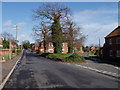
Junction of High and Low Bungay Roads Loddon
Entering Loddon from the A146 Bypass brings you to the Southern end of the High Street, access to the High School. Link to a picture of the same location in 1903.
http://www.commanet.org/reflect.aspx?action=navigate&rec=5009999900081417&dir=P&language=English&freetext=loddon&view=large
Image: © Ray Garrod
Taken: 28 Feb 2007
0.10 miles
2
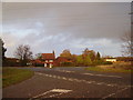
Bad Junction
This is one of the black junctions of Loddon Bypass, when the traffic is busy there are impatient and risky drivers. Many accidents have happened here as a result.
Image: © Ashley Dace
Taken: 22 Nov 2009
0.10 miles
3
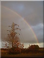
Rainbow and Electricity Pylons
The second rainbow of the day that I had seen. The electricity pylons run across the Norfolk and Suffolk countryside from Sizewell nuclear power station to the city of Norwich.
Image: © Ashley Dace
Taken: 22 Nov 2009
0.14 miles
4
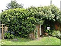
Second World War Home Guard shelter
The shelter is situated in the back garden of a private house and is used as a garden shed.
Image: © Adrian S Pye
Taken: 5 May 2014
0.14 miles
5
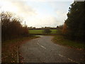
Road off to Stubbs Green
The small country road to Stubbs Green. Taken around 3.20pm
Image: © Ashley Dace
Taken: 22 Nov 2009
0.15 miles
6
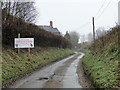
Fowl Play!
Beware Chickens and Children Playing
Image: © Adrian S Pye
Taken: 30 Dec 2010
0.16 miles
7
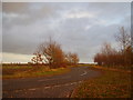
Road to Ditchingham
A small country road to Ditchingham through the nice Norfolk Countryside. Taken at around 3.20pm.
Image: © Ashley Dace
Taken: 22 Nov 2009
0.17 miles
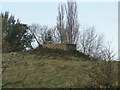
9
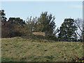
WWII Pillbox at Loddon just off the A146
One of only pillboxes left intact in the Loddon area. The other can ce seen here:
http://www.geograph.org.uk/photo/4417920
Image: © Adrian S Pye
Taken: 15 Nov 2010
0.19 miles
10
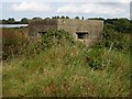
WW2 Pillbox near Loddon
A type 22 WW2 pillbox. Registered on the Defence of Britain database as S0002301. Six sided with stepped embrasures (windows).
Image: © Helen Steed
Taken: 9 Sep 2007
0.19 miles