IMAGES TAKEN NEAR TO
Mill Close, NORWICH, NR14 6AZ
Introduction
This page details the photographs taken nearby to Mill Close, NR14 6AZ by members of the Geograph project.
The Geograph project started in 2005 with the aim of publishing, organising and preserving representative images for every square kilometre of Great Britain, Ireland and the Isle of Man.

There are currently over 7.5m images from over14,400 individuals and you can help contribute to the project by visiting https://www.geograph.org.uk
Image Map
Images are licensed for reuse under creativecommons.org/licenses/by-sa/2.0
Notes
- Clicking on the map will re-center to the selected point.
- The higher the marker number, the further away the image location is from the centre of the postcode.
Image Listing (40 Images Found)
Images are licensed for reuse under creativecommons.org/licenses/by-sa/2.0
Image
Details
Distance
1
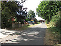
Ashby St Mary village sign
This part of Ashby St Mary is close to Thurton.
Image: © Adrian S Pye
Taken: 7 Dec 2010
0.07 miles

4
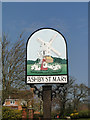
Ashby St. Mary village sign (detail)
The sign depicts a post-mill which once stood in the village from 1758 until it ceased to operate about 1910. It stood a short distance east of this sign.
The image of the lady feeding the geese is a close copy of her gravestone. Her name was Ann Basey a farmers wife, obviously well respected in her day. https://www.geograph.org.uk/photo/1463740
Image: © Adrian S Pye
Taken: 7 Apr 2015
0.07 miles
5
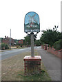
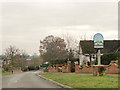
Ashby St Mary - village sign
View south along Mill Road, the main thoroughfare through Ashby St Mary. The village sign > http://www.geograph.org.uk/photo/1464859 can be seen in the foreground.
Image: © Evelyn Simak
Taken: 30 Aug 2009
0.08 miles
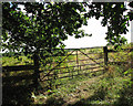
7
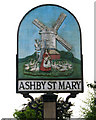
Ashby St Mary - village sign (close-up)
For a wider view of its location see > http://www.geograph.org.uk/photo/1464852. The village sign depicts the old post mill that no longer exists - the site of the mill lies a short distance further up the road - and Ann Basey, surrounded by her flock of geese, a motif which has been copied from Ann Basey's headstone in St Mary's churchyard > http://www.geograph.org.uk/photo/1463740.
Image: © Evelyn Simak
Taken: 30 Aug 2009
0.09 miles
8
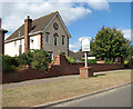
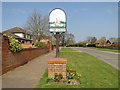
Houses and village sign in Mill Road
For a close-up of the village sign see > http://www.geograph.org.uk/photo/1464859.
Image: © Evelyn Simak
Taken: 30 Aug 2009
0.09 miles
9
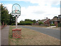
View north along Mill Road
Mill Road is the main thoroughfare through Ashby St Mary. The village sign > http://www.geograph.org.uk/photo/1464859 can be seen in the foreground.
Image: © Evelyn Simak
Taken: 30 Aug 2009
0.10 miles