
IMAGES TAKEN NEAR TO
Queens Road, NORWICH, NR1 3PN
Introduction
This page details the photographs taken nearby to Queens Road, NR1 3PN by members of the Geograph project.
The Geograph project started in 2005 with the aim of publishing, organising and preserving representative images for every square kilometre of Great Britain, Ireland and the Isle of Man.

There are currently over 7.5m images from over14,400 individuals and you can help contribute to the project by visiting https://www.geograph.org.uk
Image Map
Images are licensed for reuse under creativecommons.org/licenses/by-sa/2.0
Notes
- Clicking on the map will re-center to the selected point.
- The higher the marker number, the further away the image location is from the centre of the postcode.
Image Listing (714 Images Found)
Images are licensed for reuse under creativecommons.org/licenses/by-sa/2.0
Image
Details
Distance
1

Oasis Indian Dining
Grade II listed. http://www.britishlistedbuildings.co.uk/en-229434-phoenix-house-norfolk
Image: © N Chadwick
Taken: 29 Jun 2012
0.00 miles
2

St Francis House on Queens Road, Norwich
Whatever it was it's now offices to let.
Image: © David Howard
Taken: 7 Jul 2024
0.00 miles

4

Namaste Village on Queens Road, Norwich
An Indian restaurant.
Image: © David Howard
Taken: 7 Jul 2024
0.01 miles
5

Namaste Village
Namaste Village is a restaurat serving vegetarian and vegan food from different regions of India. The 1885 map shows this as the site of a carriage works. The date on the gable is 1887.
Image: © Evelyn Simak
Taken: 18 May 2018
0.01 miles
6

Namaste Village
Namaste Village is a restaurat serving vegetarian and vegan food from different regions of India. The 1885 map shows this as the site of a carriage works. The date on the gable is 1887.
Image: © Evelyn Simak
Taken: 18 May 2018
0.01 miles
7

Namaste Village on Queens Road, Norwich
This has the look of a Victorian pumping station and is now an Indian restaurant.
Image: © David Howard
Taken: 7 Jul 2024
0.01 miles
8

Former Primitive Methodist Church
Grade II listed. http://www.britishlistedbuildings.co.uk/en-229435-former-primitive-mehodist-chapel-norfolk
Image: © N Chadwick
Taken: 29 Jun 2012
0.01 miles
9
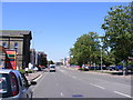
A147 Queens Road, Norwich
At the junction with Surrey Street near Sainsbury's Fuel Filling Station.
Image: © Geographer
Taken: 1 Aug 2013
0.02 miles
10

St Francis House
Originally this was a Primitive Methodist chapel, built in 1872 by architect Edward Boardman. The building currently houses one of two ATOS's (one of two profit-making companies given half a billion pounds by the government) assessment centres for Personal Independence Payment (PIP) applications in Norwich. Norfolk's disabled community is, however, describing the building as virtually inaccessible for disabled people, with the parking being across a busy 4-lane road and in case of mobility issues, the front entrance cannot be used (it has two concrete steps), to name only a few of the problems encountered here.
Image: © Evelyn Simak
Taken: 18 May 2018
0.02 miles