IMAGES TAKEN NEAR TO
Mill Close, NORWICH, NR13 6QB

Introduction

This page details the photographs taken nearby to Mill Close, NR13 6QB by members of the Geograph project.

The Geograph project started in 2005 with the aim of publishing, organising and preserving representative images for every square kilometre of Great Britain, Ireland and the Isle of Man.

There are currently over 7.5m images from over14,400 individuals and you can help contribute to the project by visiting https://www.geograph.org.uk

Image Map


Images are licensed for reuse under creativecommons.org/licenses/by-sa/2.0
Notes
  • Clicking on the map will re-center to the selected point.
  • The higher the marker number, the further away the image location is from the centre of the postcode.

Image Listing (30 Images Found)

Images are licensed for reuse under creativecommons.org/licenses/by-sa/2.0
  • ...
Image
Details
Distance
1
Pond in Salhouse
Image: © Hugh Venables Taken: 6 Aug 2016
0.09 miles
2
Bell Lane from Lower Street, Salhouse
Image: © Ian S Taken: 26 Oct 2019
0.09 miles
3
Fingerpost on Lower Street, Salhouse
Image: © JThomas Taken: 5 Oct 2023
0.09 miles
4
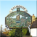
Salhouse village sign
A nice riverside scene with two men harvesting the reed for thatching watched by a bittern on her nest with chicks, while a Norfolk Wherry sails past. https://www.geograph.org.uk/photo/6704902
Image: © Adrian S Pye Taken: 14 Dec 2020
0.09 miles
5
Salhouse village sign
A nice riverside scene with two men harvesting the reed for thatching watched by a bittern on her nest with chicks, while a Norfolk Wherry sails past. https://www.geograph.org.uk/photo/6704906
Image: © Adrian S Pye Taken: 14 Dec 2020
0.09 miles
6
Village sign
The village sign at Salhouse, Norfolk
Image: © Craig Tuck Taken: 27 Jun 2009
0.09 miles
7
View southwest along Hall Farm Drive
The narrow road soon peters out into an unsurfaced track > http://www.geograph.org.uk/photo/918047 which in turn becomes a narrow path > http://www.geograph.org.uk/photo/918064 leading to Station Road > http://www.geograph.org.uk/photo/918310 and to Salhouse railway station > http://www.geograph.org.uk/photo/918373 further to the west. See > http://www.geograph.org.uk/photo/918045 for a view taken in the opposite direction.
Image: © Evelyn Simak Taken: 10 Aug 2008
0.10 miles
8
Trees in autumn colours beside Norwich Road
Image: © Evelyn Simak Taken: 21 Nov 2014
0.10 miles
9
Village sign - detail
The village sign is located on a small green by the junction of Lower Street with Bell Lane. For a wider view see > http://www.geograph.org.uk/photo/918030.
Image: © Evelyn Simak Taken: 10 Aug 2008
0.10 miles
10
Village sign
The village sign > http://www.geograph.org.uk/photo/918034 is located on a small green by the junction of Lower Street with Bell Lane. See also > http://www.geograph.org.uk/photo/918025.
Image: © Evelyn Simak Taken: 10 Aug 2008
0.10 miles
  • ...