
IMAGES TAKEN NEAR TO
Albert Shower Road, NORWICH, NR13 6FH
Introduction
This page details the photographs taken nearby to Albert Shower Road, NR13 6FH by members of the Geograph project.
The Geograph project started in 2005 with the aim of publishing, organising and preserving representative images for every square kilometre of Great Britain, Ireland and the Isle of Man.

There are currently over 7.5m images from over14,400 individuals and you can help contribute to the project by visiting https://www.geograph.org.uk
Image Map
Images are licensed for reuse under creativecommons.org/licenses/by-sa/2.0
Notes
- Clicking on the map will re-center to the selected point.
- The higher the marker number, the further away the image location is from the centre of the postcode.
Image Listing (62 Images Found)
Images are licensed for reuse under creativecommons.org/licenses/by-sa/2.0
Image
Details
Distance
1

Hangar on the Rackheath Industrial Estate
This very large building used to be one of two T2 aircraft hangars of RAF Rackheath, when it was an active airfield during WW2. It has since been modified and re-clad and is today used for storage. It can be found on the Rackheath Industrial Estate which was built on the airfield's former Technical site.
Image: © Evelyn Simak
Taken: 29 Aug 2014
0.05 miles
2
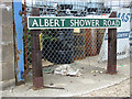
Albert Shower Road (road sign)
This road on the Rackheath Industrial Estate is named after Colonel Albert J Shower who was the base commander of RAF Rackheath when it was an active airfield during WW2, and who stayed with the 467th Bombardment Group throughout the duration of the group's stay at the station. The industrial estate was built on the airfield's Technical site and a number of roads are named after men who served there.
Image: © Evelyn Simak
Taken: 29 Aug 2014
0.05 miles
3
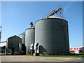
Huge silos on Rackheath Industrial Estate
Image: © Evelyn Simak
Taken: 1 Apr 2012
0.05 miles
4

View along Hudson Close
Hudson Close is the southern extension of Wendover Road, the main road through the Rackheath Industrial Estate which was built on the former Technical site of RAF Rackheath which was an active airfield during WW2. One of the T2 aircraft hangars, much modified and re-clad, can be seen at right.
Image: © Evelyn Simak
Taken: 29 Aug 2014
0.06 miles
5
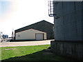
Business units on the Rackheath Industrial Estate
Image: © Evelyn Simak
Taken: 1 Apr 2012
0.07 miles
6
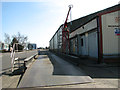
View along the road through Rackheath Industrial Estate
Image: © Evelyn Simak
Taken: 1 Apr 2012
0.07 miles
7

Industrial building on the Rackheath Industrial Estate
This modern building by the junction of Hudson Close and Dewing Road stands in the footprint of the former Quartermaster's office of RAF Rackheath, which was an active airfield during WW2. This view was taken from Hudson Close.
Three memorial plaques are affixed to the building's north wall > http://www.geograph.org.uk/photo/4143571 - http://www.geograph.org.uk/photo/4143574 - http://www.geograph.org.uk/photo/4143576.
Image: © Evelyn Simak
Taken: 29 Aug 2014
0.07 miles
8

Industrial building on the Rackheath Industrial Estate
This modern building by the junction of Hudson Close and Dewing Road stands in the footprint of the former Quartermaster's office of RAF Rackheath, which was an active airfield during WW2. This view was taken from Dewing Road.
Three memorial plaques are affixed to the building's north wall > http://www.geograph.org.uk/photo/4143571 - http://www.geograph.org.uk/photo/4143574 - http://www.geograph.org.uk/photo/4143576.
Image: © Evelyn Simak
Taken: 29 Aug 2014
0.07 miles
9

Plaque commemorating the 467th Bombardment Group HVY Ancillary Units
This plaque is one of three on the wall of a modern building > http://www.geograph.org.uk/photo/4143567 on the Rackheath Industrial Estate, which was built in the footprint of the former Quartermaster's office. The industrial estate occupies the Technical site of the WW2 airfield of RAF Rackheath.
Image: © Evelyn Simak
Taken: 29 Aug 2014
0.07 miles
10

Memorial plaque to Private Daniel E Miney
Private Miney was killed in action on 22 April 1944, when enemy aircraft bombed the airfield.
This plaque is one of three on the wall of a modern building > http://www.geograph.org.uk/photo/4143567 on the Rackheath Industrial Estate, which was built in the footprint of the former Quartermaster's office. The industrial estate occupies the Technical site of the WW2 airfield of RAF Rackheath.
Image: © Evelyn Simak
Taken: 29 Aug 2014
0.07 miles